Last updated: March 19, 2022
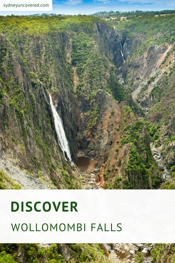
Wollomombi Falls is an enormous plunge waterfall located 40 km east of Armidale in the Oxley Wild Rivers National Park in the New England region of New South Wales.
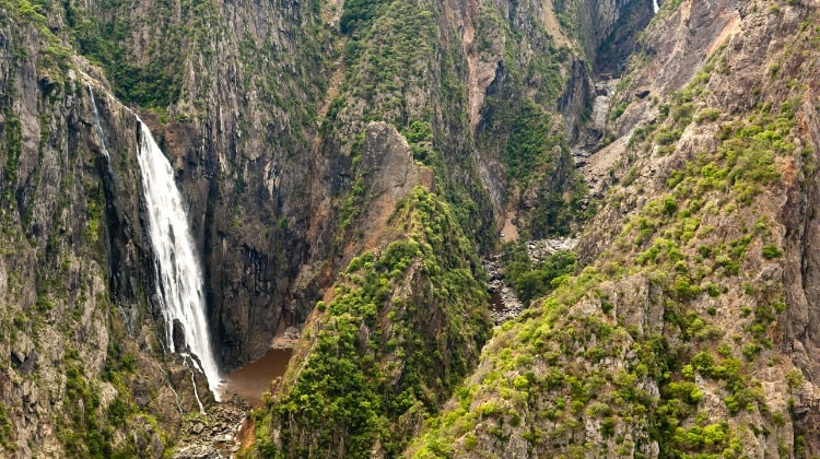
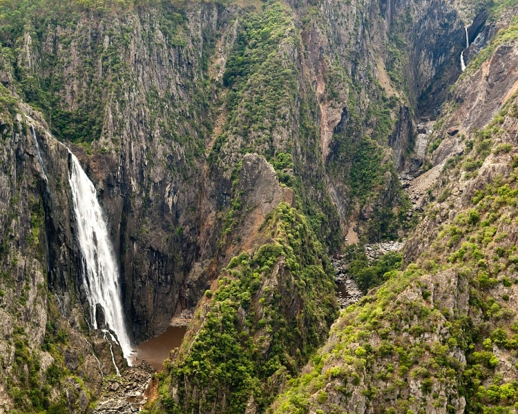
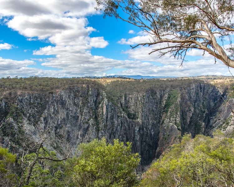
With a height of well over 200 metres, the Wollomombi Falls were once considered the highest waterfall in Australia.
Nearby Chandler Falls may be a bit smaller but is still impressive enough, especially after a period of rainfall.
Keep reading to find out more about these two waterfalls, and the walking tracks and lookout points in this beautiful area.
How to Get There
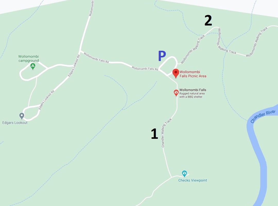
From Armidale, follow Grafton Rd / Waterfall Way for about 40 km when you turn into Wollomombi Falls Rd. After 2 km turn left at the fork which takes you to the car park with barbecue and toilet facilities (see map location).
If you’re driving in from the Coffs Harbour or Bellingen area, follow Waterfall Way until you make a left turn into Grafton Rd, shortly after Ebor Falls. Stay on Grafton Rd for another 40 km before turning left into Wollomombi Falls Rd.
Please note that dogs and other domestic animals are not permitted in the area as it is a national park.
In the below map:
P: Wollomombi Falls picnic area car park.
1: Chandlers walking track.
2: Wollomombi walking track.
About Wollomombi Falls
Most visitors to Wollomombi Falls combine this majestic waterfall with other waterfalls nearby, such as Ebor Falls and Dangar Falls.
They are all located along the scenic Waterfall Way, a popular long-weekend getaway destination for Sydney-siders and Queenslanders.
The best time to visit Wollomombi Falls is after heavy rainfall, when the two waterfalls carry the most water and the gorge turns a bit misty. If you’re lucky, you may even spot a rainbow.
It’s recommended to schedule in enough time to spend in this area, because the scenery will blow you away. The two thundering waterfalls and the massive gorge below will leave a lasting impression.
The name of the waterfall stems from the aboriginal word Wollomombi, which roughly means “meeting of the waters”, referring to the confluence of the Wollomombi River and Chandler River in the Wollomombi Gorge.
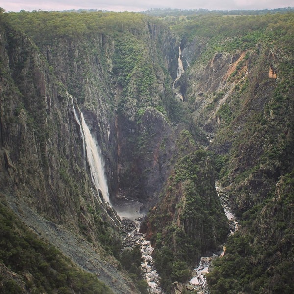
The above image, taken after a period of rainfall, is a great visual representation of how the two rivers join, with Wollomombi Falls on the left and the smaller Chandler Falls on the right, further away.
This incredible scenery is a result of millions of years of erosion.
Wollomombi Falls: -30.531806, 152.039833
Chandler Falls: -30.533694, 152.047389
Wollomombi Falls Picnic Area
The Wollomombi Falls picnic area has excellent facilities, with several barbecues, (non-flush) toilets, lots of picnic tables, drinking water, and a large car park.
From there, you can explore the area further, and perhaps do one or more of the walking tracks that lead to several scenic lookout points.
It may also be worthwhile to visit the camping ground nearby, which is home to the Edgars Lookout. This is a great viewpoint with scenic views of the western part of Wollomombi Gorge.
Walking Tracks and Lookouts
There are two main walking tracks in the area that both give you a good sense of how uniquely beautiful this part of the world is:
- Chandler Walking Track
- Wollomombi Walking Track
It’s recommended to do both these tracks because the views of the waterfalls, the rivers and the massive valley are absolutely stunning. Both walks are fairly easy with only a few steep parts on the way to the lookouts.
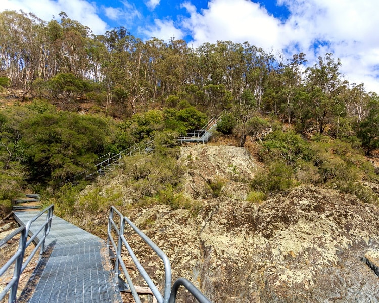
1. Chandler Walking Track
The Chandler Track is a relatively easy 1.4 km (2.8 km return) walk that includes three scenic lookout points.
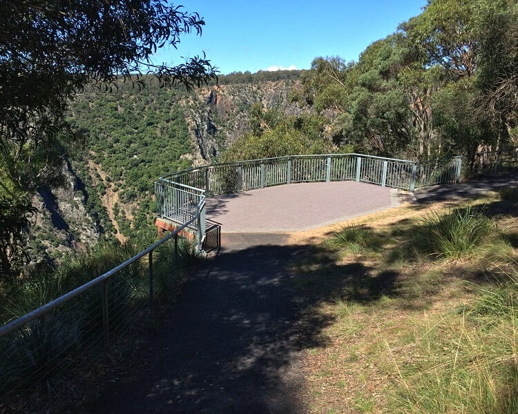
The main lookout is only a few steps away from the car park and picnic area, and offers the best views of the Wollomombi Waterfall and the huge gorge.
This wheelchair-accessible lookout platform is relatively new and the views are absolutely stunning.
The second viewpoint, Checks Lookout, is a bit smaller but offers similarly impressive views as the first one. You can then continue the track to the third lookout, the Chandler Viewpoint.
Until recently, the track would continue all the way down to the river, but this section of the track has been closed. Ongoing erosion and often very steep parts have turned this into a hazardous track.
2. Wollomombi Walking Track
The Wollomombi Walking Track guides hikers along the north side of the gorge rim, taking in various lookout points. The Eagle Lookout is the first viewpoint which offers great views of the gorge from a different angle.
The track then crosses the Wollomombi River leading to another lookout closer to the waterfall, followed by a lookout point that offers scenic views of the Chandler Waterfall.
The Wollomombi Walking Track is a moderate 4 km return trail that can be completed within two hours including stops.
It can easily take a lot longer though, depending on how impressed you are by the fantastic views.