Last updated: April 16, 2024
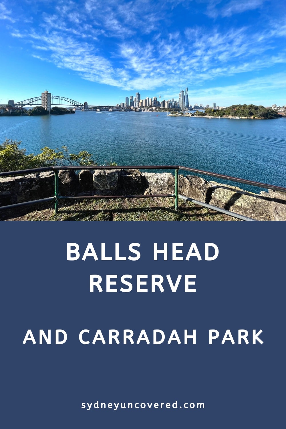
Balls Head Reserve on Sydney’s lower north shore is a beautiful forested headland nature reserve facing Sydney Harbour.
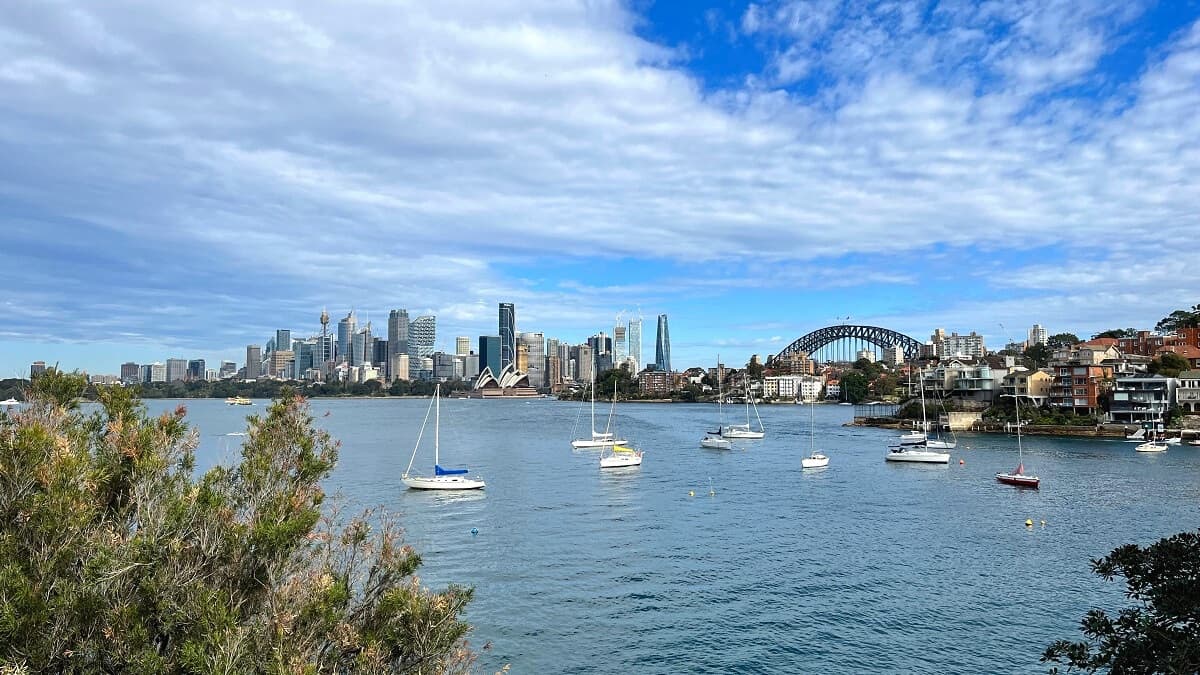
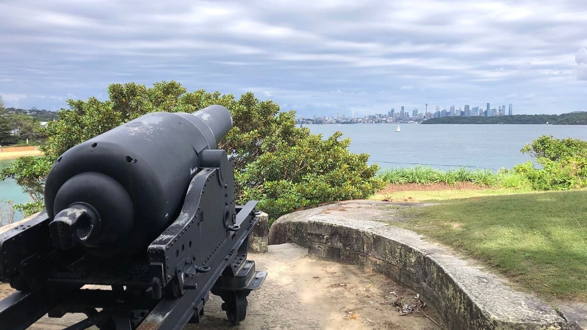
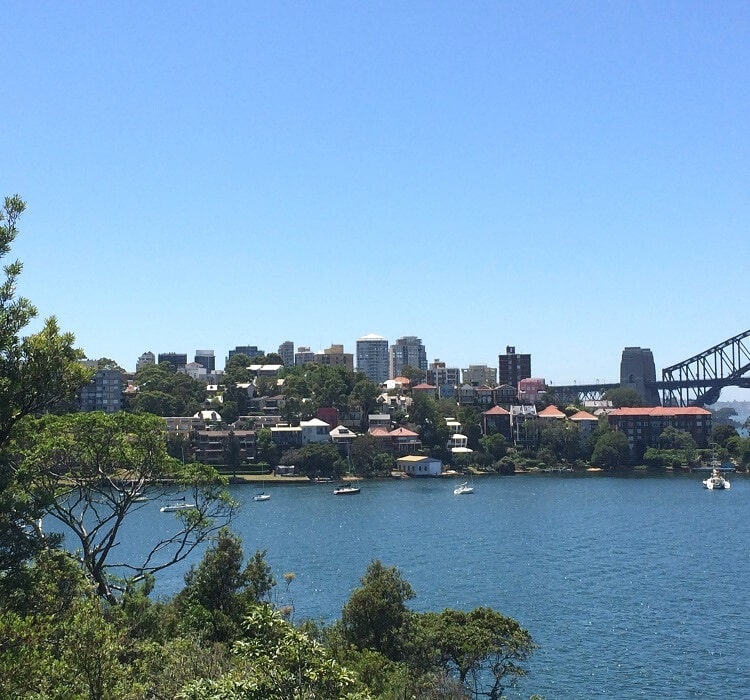
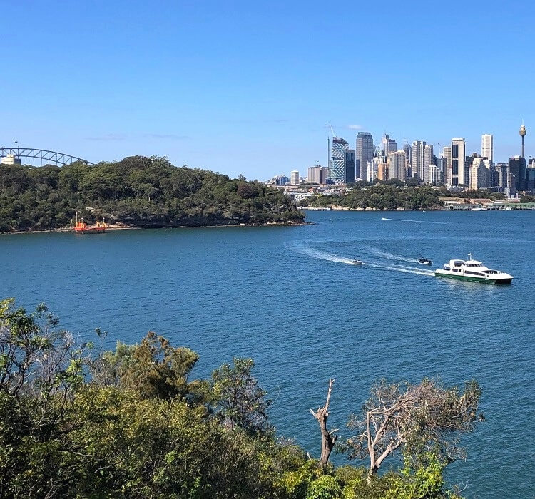
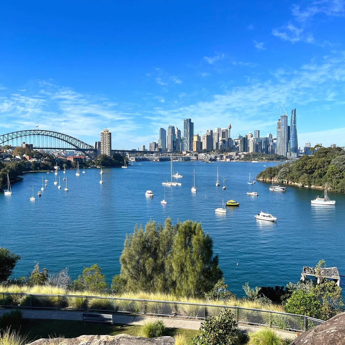
The reserve is home to various short bushwalking trails that combine natural beauty with great views across Sydney Harbour, the CBD skyline, the Harbour Bridge, Goat Island, and the surrounding peninsulas.
Nearby Carradah Park on the Waverton Peninsula is also a must-visit, as its rich history, serene atmosphere, and panoramic views make it an exciting place to explore.
| Balls Head Reserve Walk | |
|---|---|
| Distance: | Approx 2 km (various trails) |
| Duration: | 1-2 hours (depending on stops) |
| Grade: | Easy |
| Dogs: | On a lead |
How to Get There
Boasting 9 hectares of scenic bushland, Balls Head Reserve is still a bit of a hidden gem, located only 1.5 kilometres from the Sydney CBD.
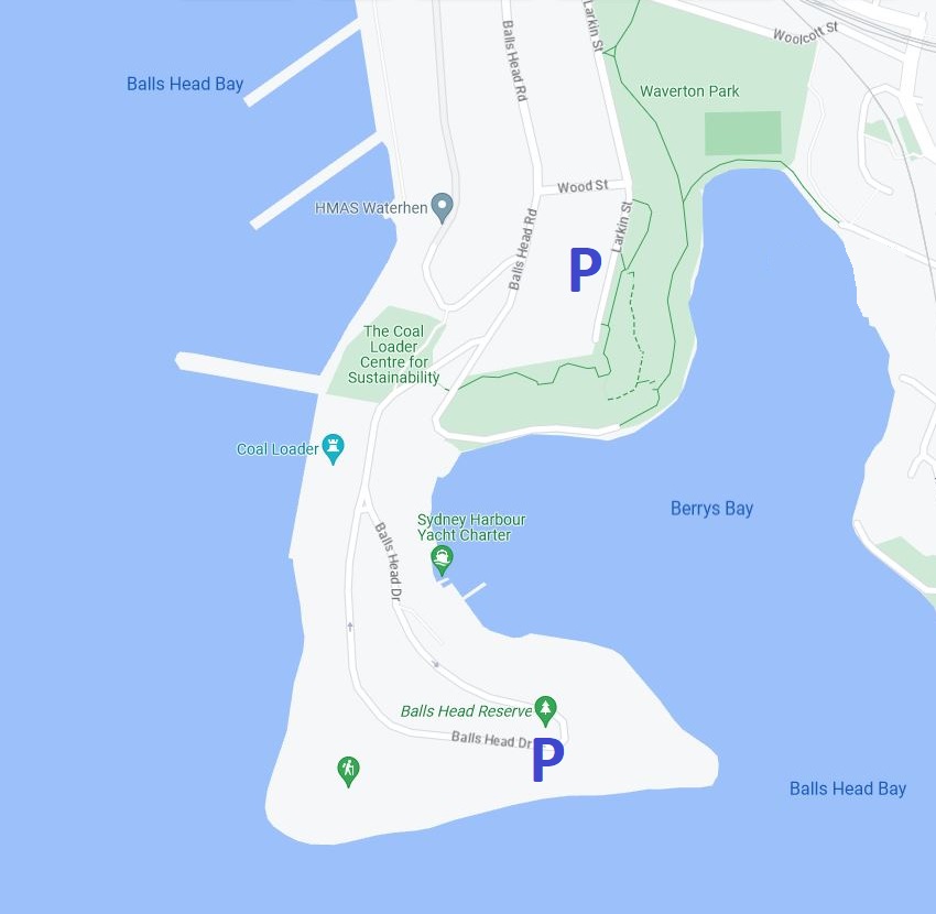
The Reserve is located at the southern end of Balls Head Drive on the Waverton Peninsula. There is a small car parking area within the Reserve, and free street parking is available on Balls Head Road. If you’re going to Carradah Park, you can park your car on Larkin Street.
The area is also easy to travel to by public transport, with Waverton train station only a short 10-minute walk away.
To start exploring Balls Head Reserve, starting from the car park, it’s recommended to follow the path towards the north and then keep walking in a clockwise direction, eventually ending up at the Coal Loader.
Official address of Balls Head Reserve (see map location):
Balls Head Drive
Waverton NSW 2060
Balls Head Reserve
A visit to Balls Head Reserve is a few hours well-spent. It’s still a bit of a hidden gem, so it usually doesn’t get too busy there.
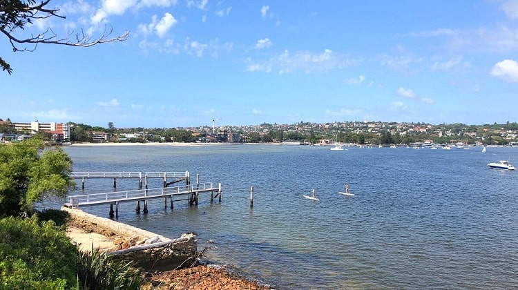
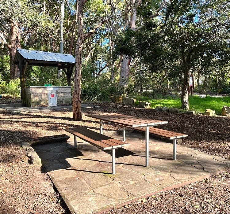
Balls Head Reserve is not only a great destination for some light bushwalking but also a perfect spot to have a relaxing picnic in natural surroundings.
The Reserve was named after Henry Lidgbird Ball, a Royal Naval officer and commander of one of the ships that were part of the First Fleet that arrived in Botany Bay in 1788.
Before the arrival of white settlement, the Cammeraygal people lived in this part of New South Wales. Middens, art sites, and rock engravings are still present in the Reserve and surrounding area. Yerroulbine is the Aboriginal name for Balls Head.
Public Parkland
In 1926, along with Berry Island, Balls Head Reserve was declared a public parkland area.
During the depression years of the 1930s that followed, the area was often used for shelter, and much of the original vegetation was lost.
A beautification scheme was introduced to restore the natural beauty of this sandstone headland.
Now managed by North Sydney Council, the Reserve is a beautiful place to wander around and explore.
Walking Trails
Balls Head Reserve is home to several short bush walking trails that are all connected. To get a better understanding of these trails, it’s recommended to check out the information board at the car park.
One of the trails, the Harbour View Walk, is wheel-friendly and offers scenic views of Sydney Harbour and the CBD.
Hiking on Balls Head Reserve is quite a unique experience in the sense that it’s real bushwalking while still being very close to the city.
The tracks are easy to follow, but there are a few mildly steep climbs. Good hiking shoes are certainly recommended.
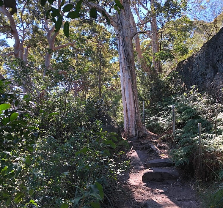
Even though the trails are well-signposted, things can get a bit confusing with the various intersections and the lack of a designated starting point.
Our recommendation is to follow the path north from the car park (Midden Walk) and follow the shoreline of the Reserve in a clockwise manner.
When you get to the easternmost point (a grassy area) of Balls Head Reserve, choose the Ballasters Track going west.
This eventually connects with the Harbour View Walk at the picnic area. From there, follow the Isabella Brierly track heading further west.
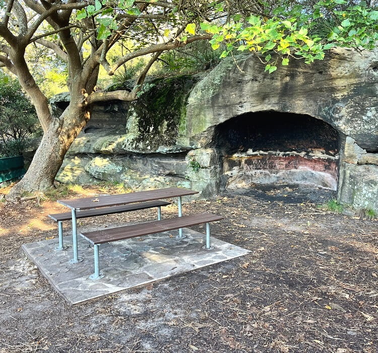
You will find some rest areas, benches, and caves along the way where you can sit, rest up, and enjoy the views.
You can then choose to follow the Coal Loader Link track to the Coal Loader Centre for Sustainability, or head back to the car park.
The Coal Loader is quite an interesting and unique spot, so we recommend continuing on that trail and checking out the Coal Loader.
The Coal Loader
Run by North Sydney Council, the Coal Loader has transformed a former industrial site into a unique place where people can come to learn more about sustainable living.
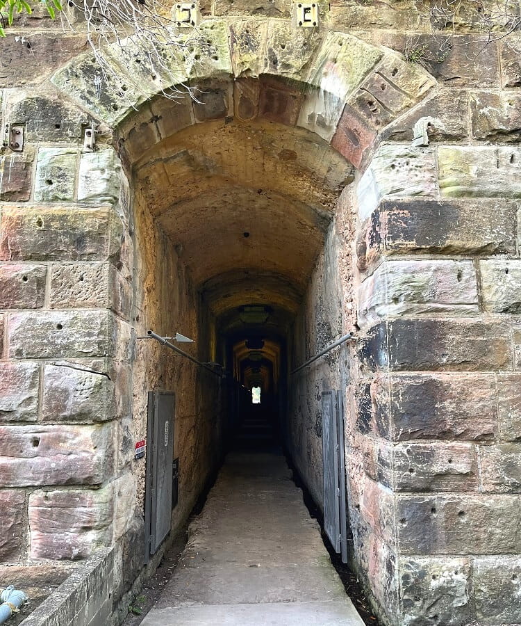
It’s become a place to relax, be inspired, or simply grab a coffee and learn more about sustainable technology, community gardens, native bush nurseries, and regenerated parklands.
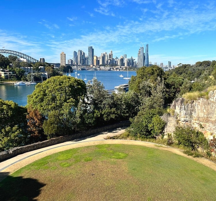
One of the highlights of the Coal Loader is the modern Coal Loader Platform, a beautiful open green roof space.
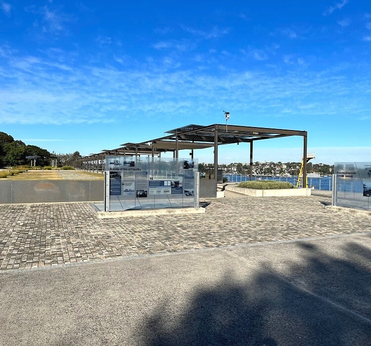
One hectare in size, this concrete and sandstone platform structure is designed to be a multi-purpose recreational space, with spectacular views of the harbour as a bonus.
Balls Head Reserve Facilities:
- Toilets
- BBQ and picnic tables
- Water fountain
- Walking tracks
- Shelter and benches
- Free parking area
Carradah Park
When visiting Balls Head Reserve, a visit to its neighbour, Carradah Park on the Waverton Peninsula, is a must.
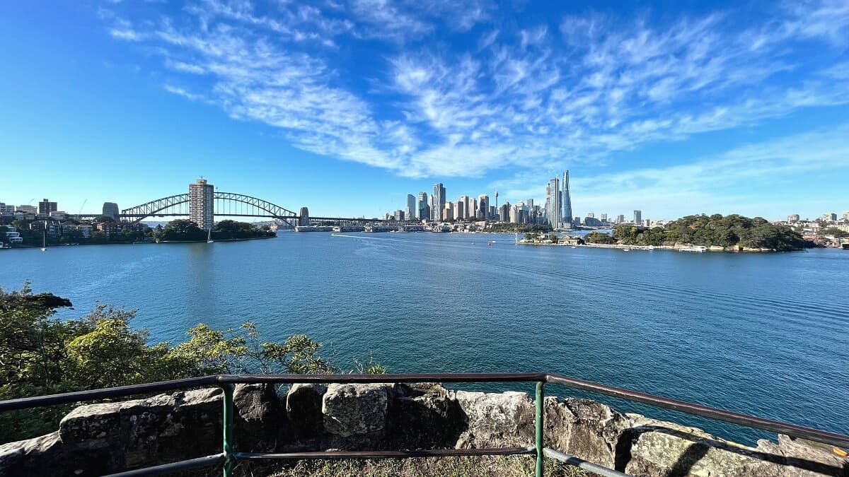
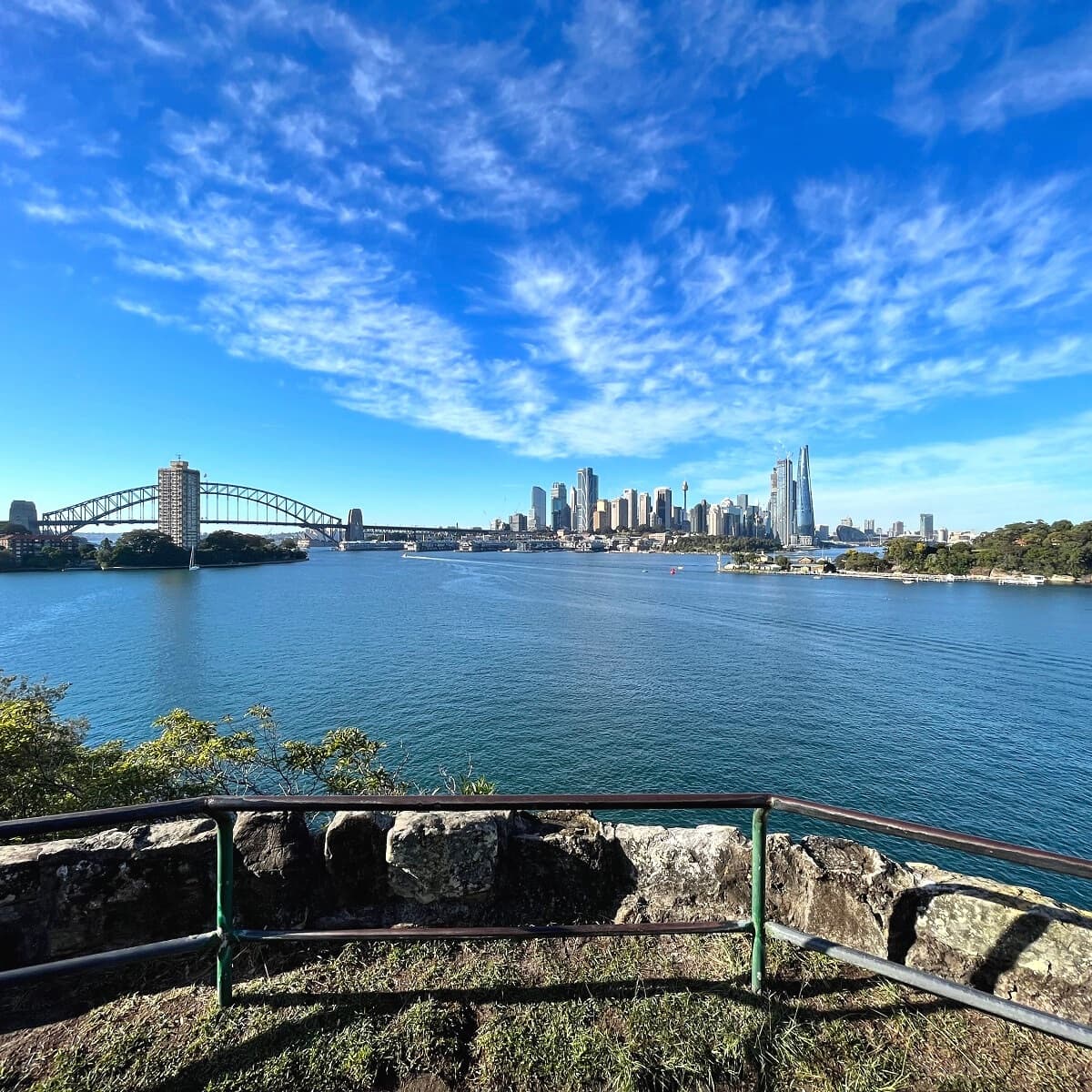
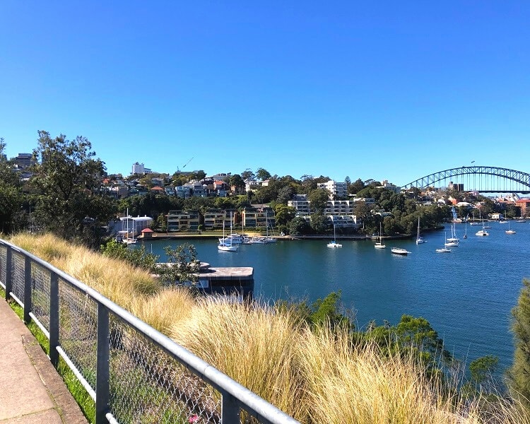
It’s one of those magical places where you can enjoy breathtaking views of the Sydney CBD skyline and Sydney Harbour without any noise.
Overlooking Berrys Bay, Carradah Park has quite a rich history. In the 20th century, the area was used as a major oil storage facility.
BP Australia ceased its operations there in 1993, and in 2005, the Waverton Peninsula was re-opened as a public parkland.
In the years following 1993, a transformation project changed the area from industrial to recreational. BP Australia also invested heavily in this transformation.
Some remnants of the industrial use were retained and incorporated into the new design. For example, the big circles in the park represent the locations of the big oil tanks.
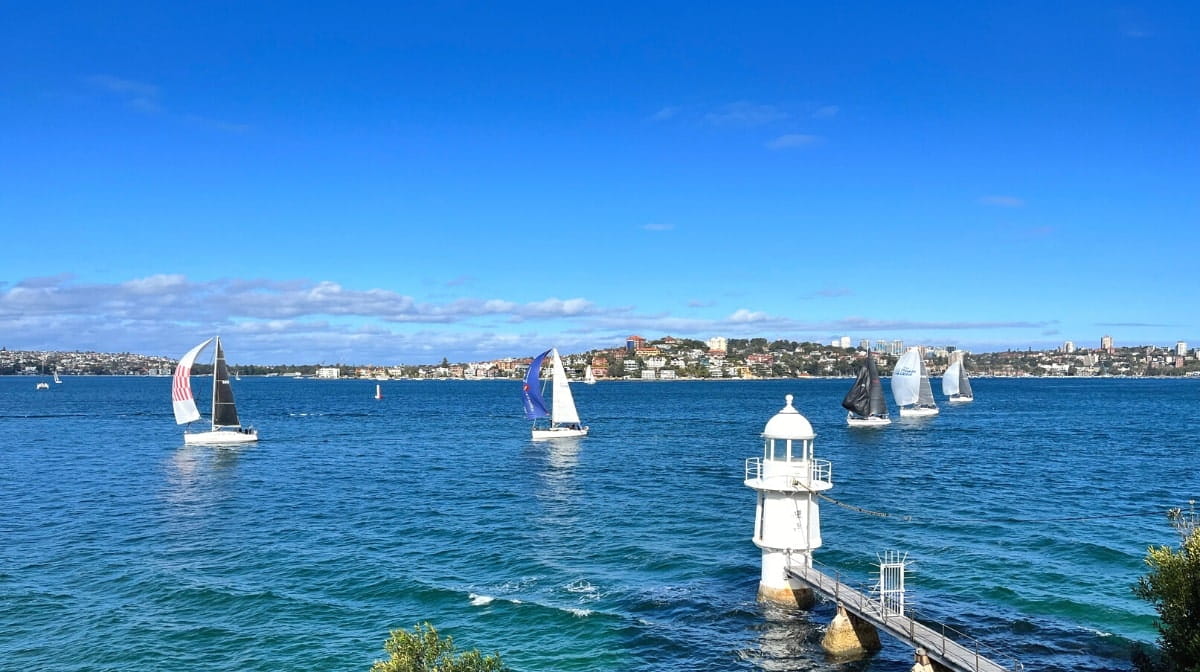
The park is now home to several great walking trails with various beautiful lookout points along the way to enjoy.
The most prominent vantage point is the Berrys Bay Lookout, which offers fantastic views of Sydney Harbour, the city skyline, and the Harbour Bridge.