Last updated: April 22, 2024
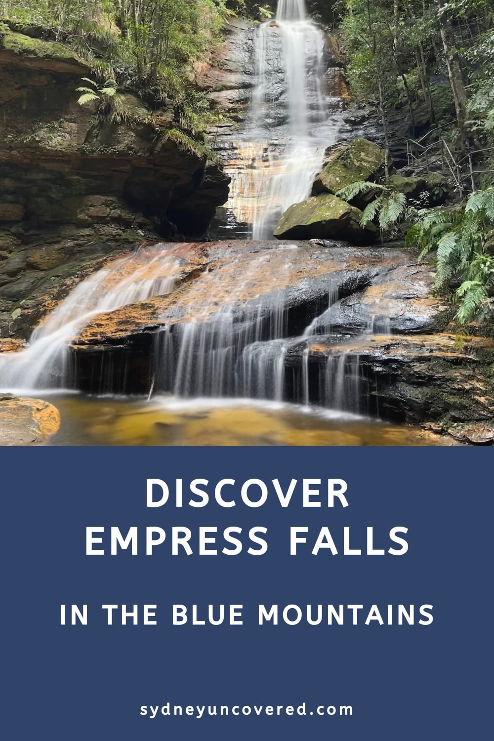
Empress Falls is one of the prettiest waterfalls in the Blue Mountains, accessible via a short but steep walking track from the Conservation Hut.
The short walking trail to Empress Falls forms part of the longer Valley of the Waters walking track, one of the most popular bush walks in the area.
| Empress Falls Walk | |
|---|---|
| Distance: | 1 km (return) |
| Duration: | 1 hour |
| Grade: | Moderate (short but steep) |
| Dogs: | Not allowed |
How to Get There
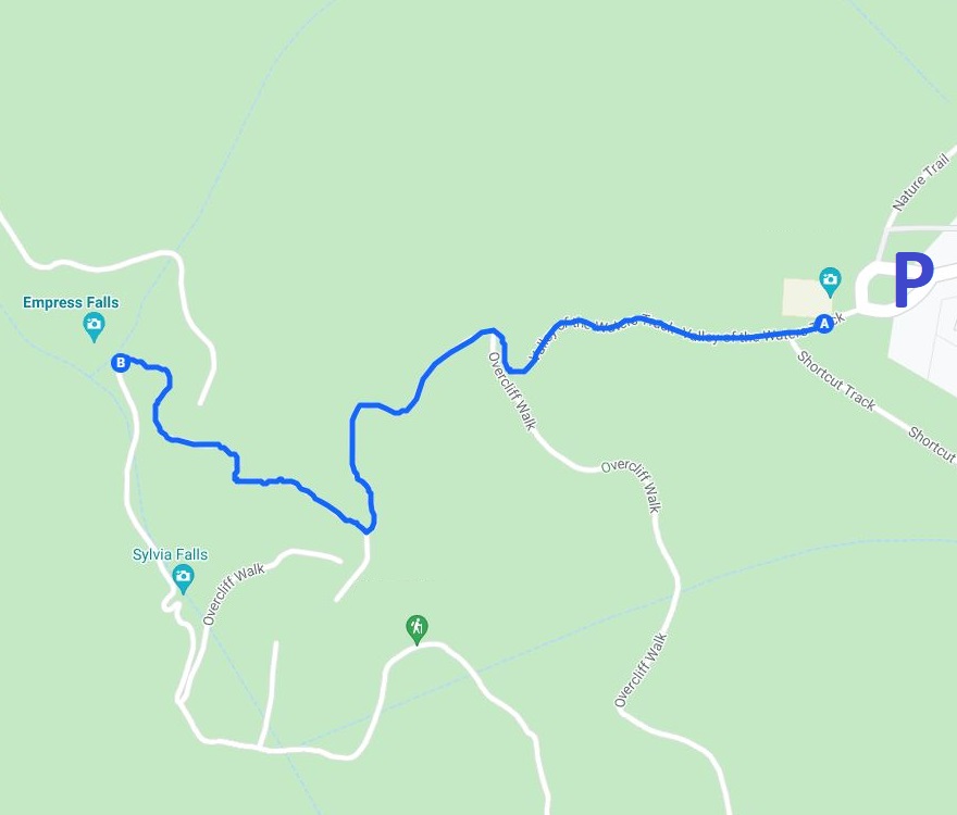
The return walk to Empress Falls starts and ends at the Conservation Hut, located at the end of Fletcher Street in Wentworth Falls (see map location).
Getting to the Conservation Hut is easy. From the Great Western Highway, take the exit into Falls Road in Wentworth Falls, followed by a right turn into Fletcher Street, which leads to a car park.
The car park at the Conservation Hut is relatively small and does fill up quickly on the weekends. If it’s full, try suburban street parking nearby.
The map below gives you an idea of where this beautiful walk is located and where you can park your car.
Track Notes
The walk down to Empress Falls is relatively short, but it’s also steep. While going down is easy, the return trip can be quite challenging.
We recommend bringing a bottle of water with you, especially on warmer days. It’s also important to wear good hiking shoes, as the trail can be quite slippery in wet conditions.
We’re going to describe the walk along the following highlights:
- Queen Victoria Lookout
- Empress Lookout
- Empress Falls
- Sylvia Falls (optional)
Start of the Walk
As mentioned, the walk starts at the Conservation Hut, which is now a cafe.
Initially opened in 1963 as a meeting place for the Blue Mountains Conservation Society, the Conservation Hut operated as a cafe from 1993 following a major building redevelopment but closed in 2021. A new cafe opened in 2023.
There are several walking tracks in the Wentworth Falls area that start and finish at the Conservation Hut, such as the Overcliff Undercliff Track, Wentworth Pass, and Nature Track.
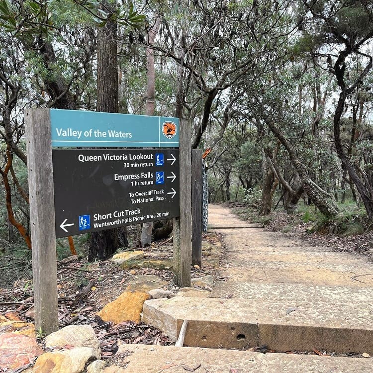
To find the start of the Empress Falls walking track, look for the sign that says Valley of the Waters, Queen Victoria Lookout, and Empress Falls.
1. Queen Victoria Lookout
The first section of the walk to the Queen Victoria Lookout is a relatively easy path heading down via a series of wooden steps.
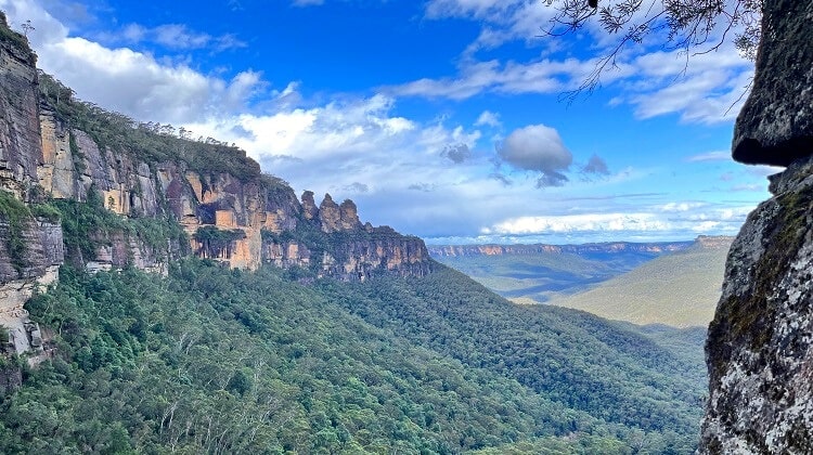
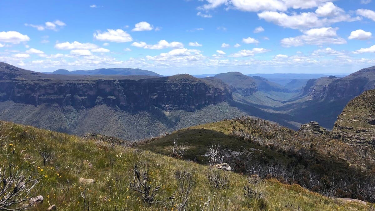
After about 300 metres, a short side track opens up to the Queen Victoria Lookout, situated above the Valley of the Waters and facing Jamison Valley.
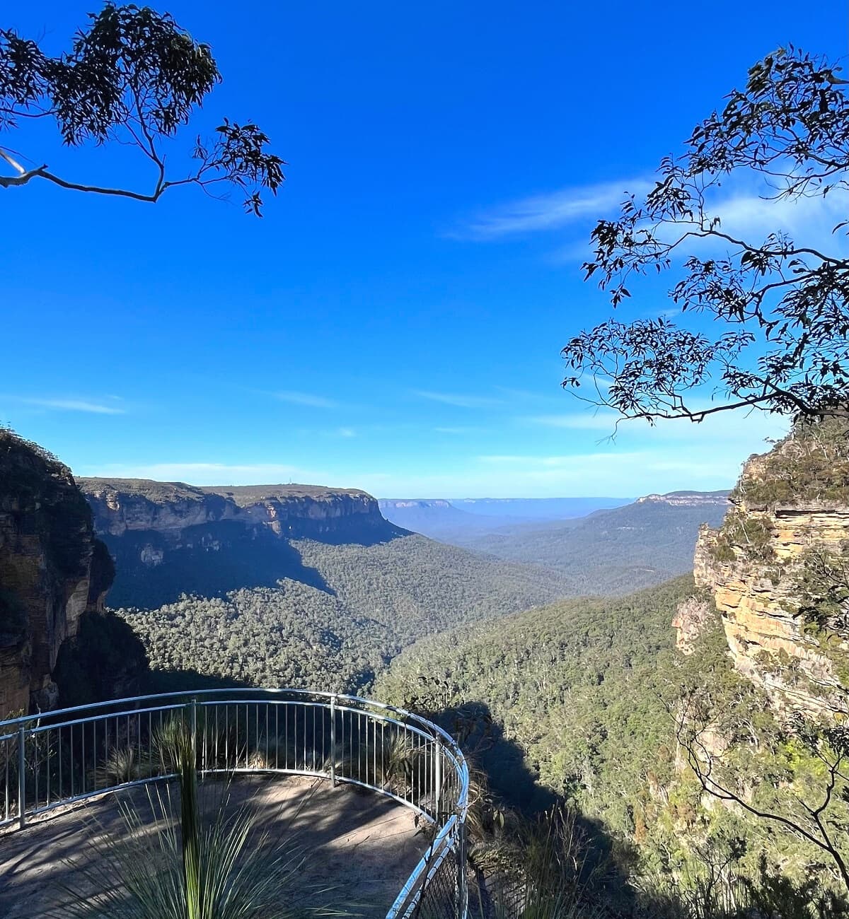
The views are absolutely stunning and reach as far as Mount Solitary straight ahead. To the east, Kings Tableland can also be seen.
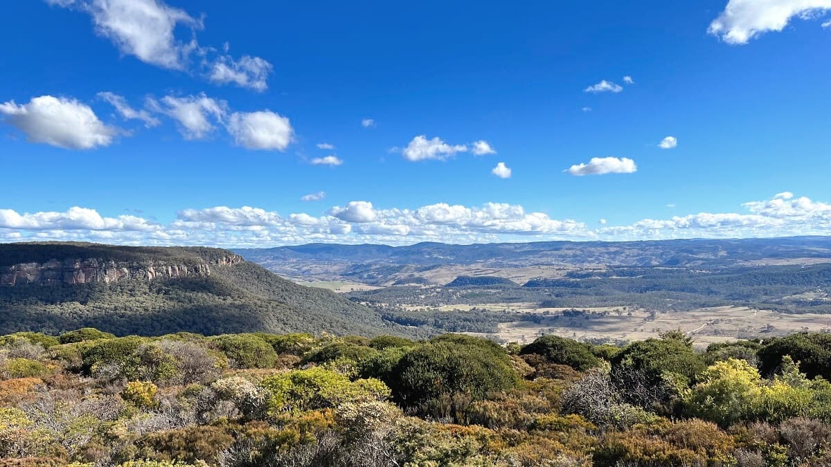
2. Empress Lookout
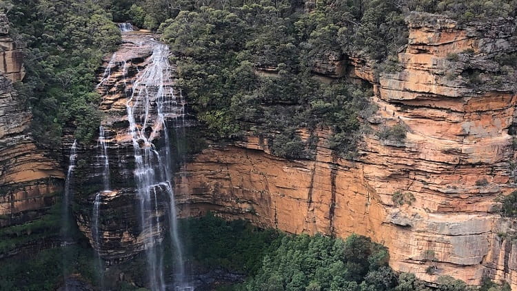
The next stop is the Empress Lookout which faces the other side of the valley where Empress Falls and the Empress Canyon are located.
Interestingly, the Empress Lookout, despite the name, doesn’t actually offer views of Empress Falls. You can certainly hear the waterfall, especially when there’s lots of water flowing, but it is hardly visible through the many trees.
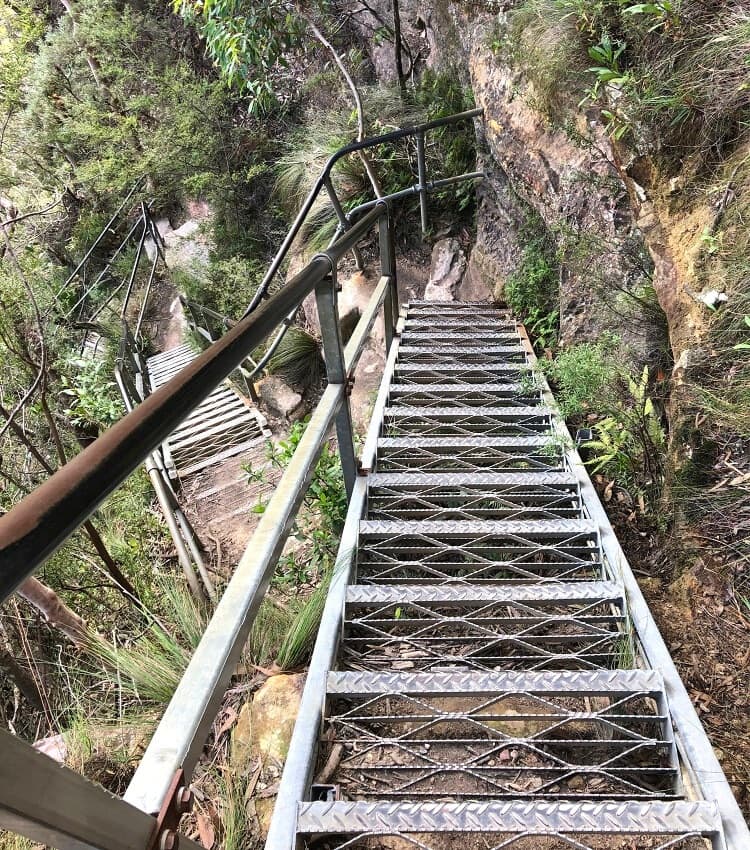
Nonetheless, the views from the lookout are pretty enough to go and check it out. From the Empress Lookout, the track heads further down into the valley via a series of metal staircases.
While it may look a bit scary in the photo above, the staircases are pretty easy to navigate with the handrails.
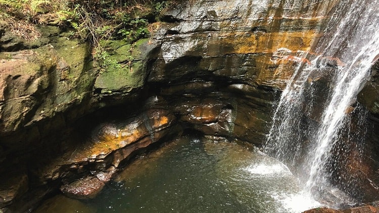
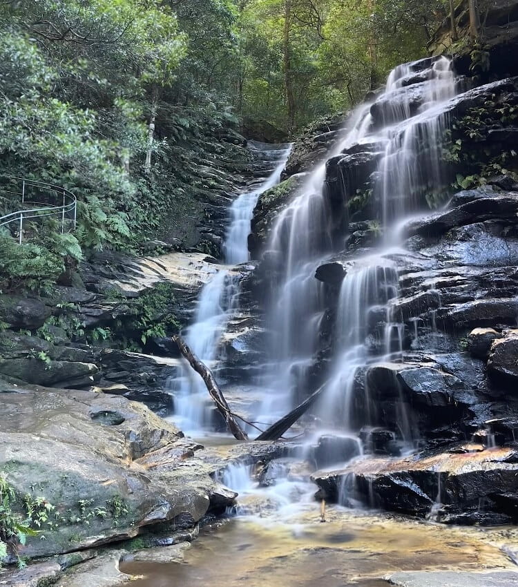
3. Empress Falls
Once you’ve conquered the stairs, you will notice that the scenery gets a lot darker all of a sudden, as the many trees and cliff walls are blocking some of the natural sunlight.
This is also where the walking track slowly turns into a rainforest walk, which is quite a fascinating contrast with the dryer bush trails on higher ground.
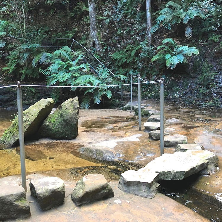
After passing the intersection with the Nature Track, the path to Empress Falls soon crosses a creek via a set of stepping stones.
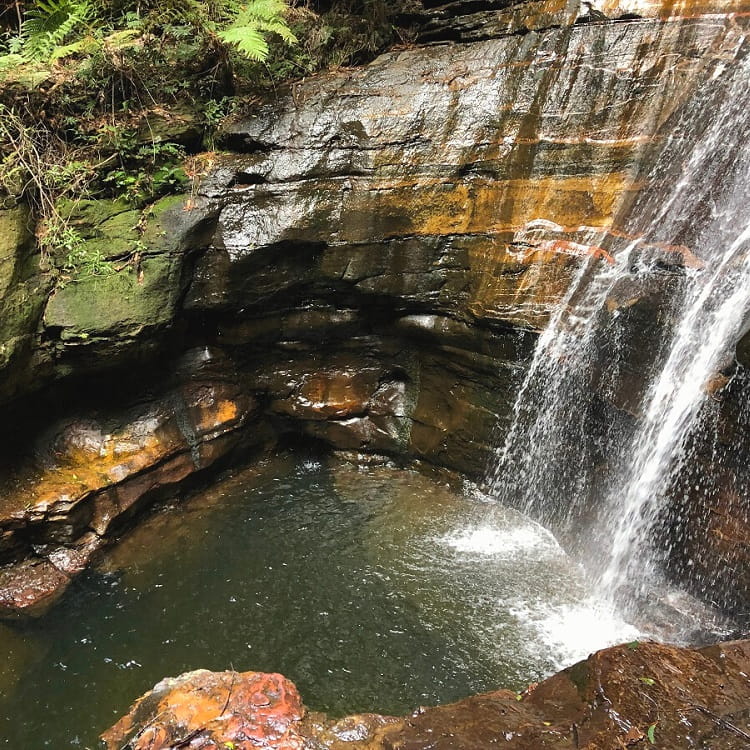
You will now start seeing the first glimpses of Empress Falls, which can be very impressive, especially after a period of rainfall when more water thunders down into the natural pool below.
The track eventually brings hikers right next, and in front of, the waterfall, surrounded by boulders and trees, creating a majestic atmosphere.
The stepping stones in front of the waterfall are the perfect spot to take a photo of the entire waterfall.
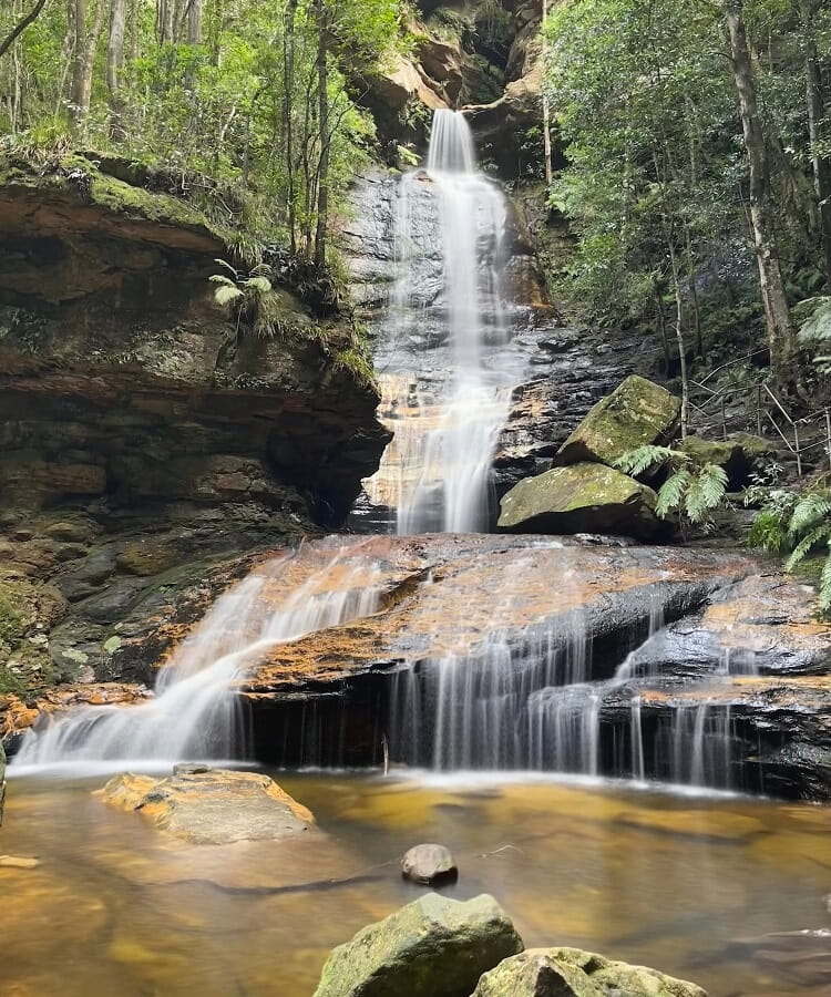
4. Sylvia Falls (Optional)
If one beautiful waterfall isn’t enough, continue on the path downstream along the creek to visit another beautiful waterfall.
Sylvia Falls is a scenic cascade waterfall, not too far away from Empress Falls. Simply follow the trail and the steps down and the waterfall appears very soon.
Beyond Sylvia Falls, the trail continues even further to Lodore Falls, Flat Rock Falls, Brittania Falls, Red Rock Falls, and Vera Falls.
However, the walking track to these waterfalls, and Vera Falls specifically, becomes more challenging and is recommended for experienced bushwalkers only.
Hi, wondering if you are allowed to swim right at the bottom of Empress Falls.
Hi Tony,
To our knowledge, yes, that is allowed. Although you’re going to have to be careful with the abseilers who often go there.
Check out our Blue Mountains swimming holes article for more options. The one at Victoria Falls is pretty good, but it’s a steep hike to get there.
How far off are Sylvia and Lodore Falls from empress falls? And can you swim in any of these falls at the moment?
Thank you!
Sylvia and Lodore Falls are actually quite close to Empress, you’d have to add another 500 metres or so on a well maintained path. But you can’t really swim there.
Together with my family we were truly challenged to beautiful waterfalls. I enjoy this walk every year, even though the steps are steep. I highly recommend the experience but do take a friend.
Thanks Rose, glad to hear you enjoyed this walk down to Empress Falls. And you’re right, it’s always a good idea to bring someone with you, or otherwise let others know where you are, when heading into the bush for a hike.
This looks and sounds amazing but I am really scared of heights so need to see pictures of the stairs. Does anyone have any photos they share so I can decide if it’s something I can do? Am planning to do a blue mountain trip this weekend but need to assess which walks I am capable of doing. Appreciate your guidance and any photos! Thanks.
Hello Cath, if you’re scared of heights, then you will most likely be fine on the Empress Falls walk.
The track is steep in some sections, but the steps are mostly through the bush, so height isn’t much of an issue. There is one section with a series of steel staircases, but there are handrails and it’s easy to navigate. I have just added a picture in the article to give you an idea of what to expect.
Hope this helps a bit.
Hi, I was just wondering how long is the walk to get to the waterfall, and is it recommended for younger kids like from 5 years old?
Hi Sonya, it’s a 1 km return walk to the waterfall, so not that long. It is steep, but kids that age can certainly do it. Some kids can power through these walks better than adults, but it also depends on their mood and how much they enjoy being outdoors.