Last updated: October 30, 2023
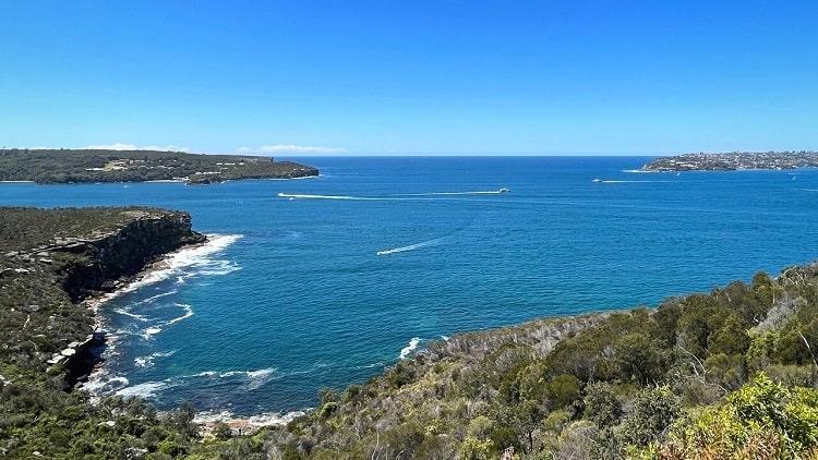
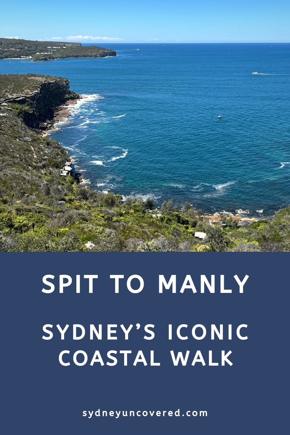
The Spit Bridge to Manly Walk is an iconic 10 km coastal walking trail, featuring beautiful Sydney Harbour beaches, scenic bushland, picturesque bays, and panoramic lookout points.
The walk forms part of the 20 km Manly Scenic Walkway that runs from the Spit Bridge to Manly North Head, and is widely considered one of the best coastal walks in Sydney.
In this article, we’re going to guide you through the many highlights of the Spit to Manly walk, including pictures, insider tips, and a map.
| Spit to Manly Walk | |
|---|---|
| Distance: | 10 km (one way) |
| Duration: | 3-5 hours |
| Grade: | Moderate |
| Dogs: | Not allowed on some sections |
How to Get There
Public transport is recommended, but there are a few options if you prefer to go by car.
Car:
You can park your car north of the bridge on Battle Boulevard, or south of the bridge at the Spit Bridge Reserve. Use a taxi or public transport to return to your car after completing the walk.
If you do the walk in the other direction, there are quite a few reasonably priced car parks in the Manly area.
You can also cut the walk short and park at Clontarf Reserve (paid parking), or at Tania Park in Balgowlah Heights, which has ample parking.
Public Transport:
Catch a bus from Wynyard station in the Sydney CBD to the Spit Bridge. In Manly, you can either catch a bus or a ferry back to the city. A ferry to Circular Quay is highly recommended.
Check the bus and ferry services on the NSW Transport Info website.
With an Opal Card, you can use unlimited public transport on the weekends for a small capped daily fee.
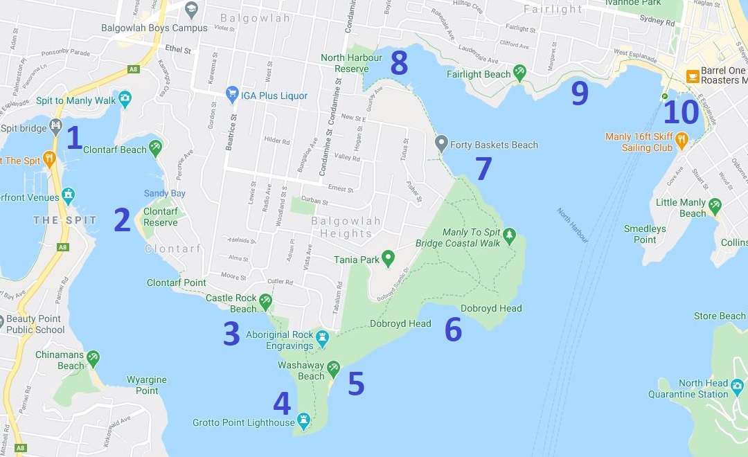
Highlights and Map
There are many things to see and do along the walking track between the Spit Bridge and Manly Beach, but in this article, we’re going to focus on the following ten highlights and landmarks:
- The Spit Bridge
- Clontarf Reserve
- Castle Rock Beach
- Grotto Point Lighthouse (optional)
- Washaway Beach (optional)
- Dobroyd Head Lookouts
- Reef Beach and Forty Baskets Beach
- North Harbour Reserve
- Fairlight Walk
- Manly Wharf
In the track notes below, we’re diving a little deeper into each of these landmarks, as we navigate the trail from west to east.
Here is a handy map for your reference, with the highlights marked from 1 to 10, starting at the Spit Bridge:
Spit to Manly Track Notes
The official starting point of the Spit to Manly walk is at the northern end of the bridge.
A staircase at the southern end of Battle Boulevard heads down to the water, where you’ll need to turn left (eastbound).
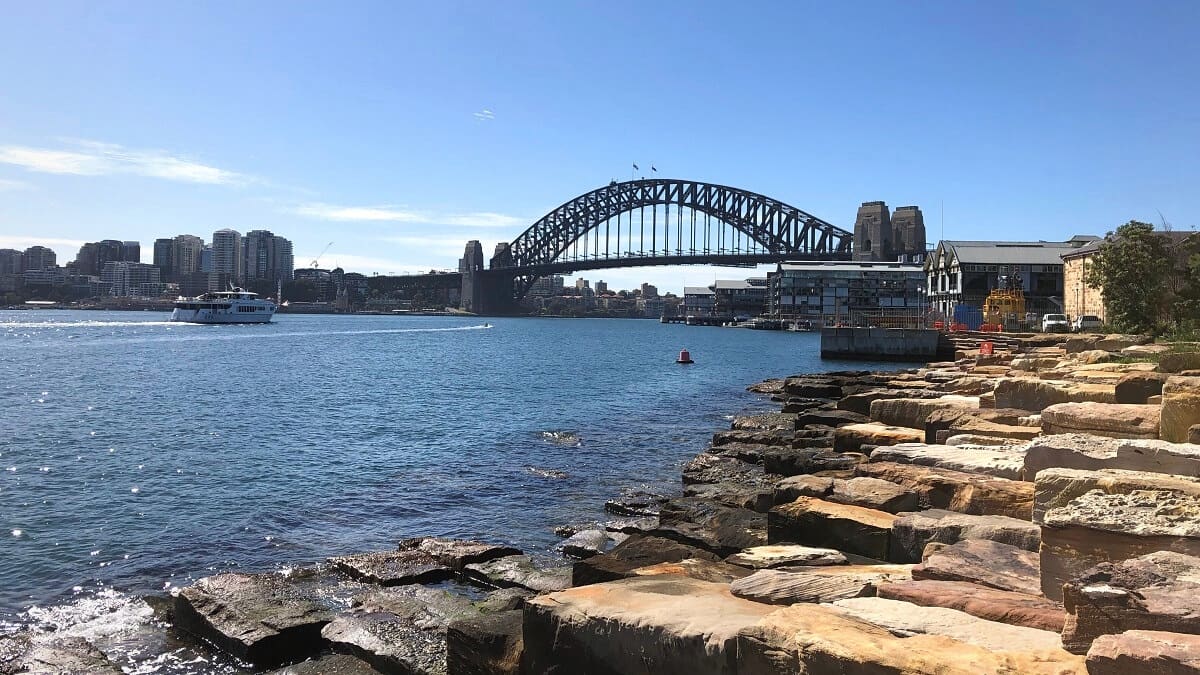
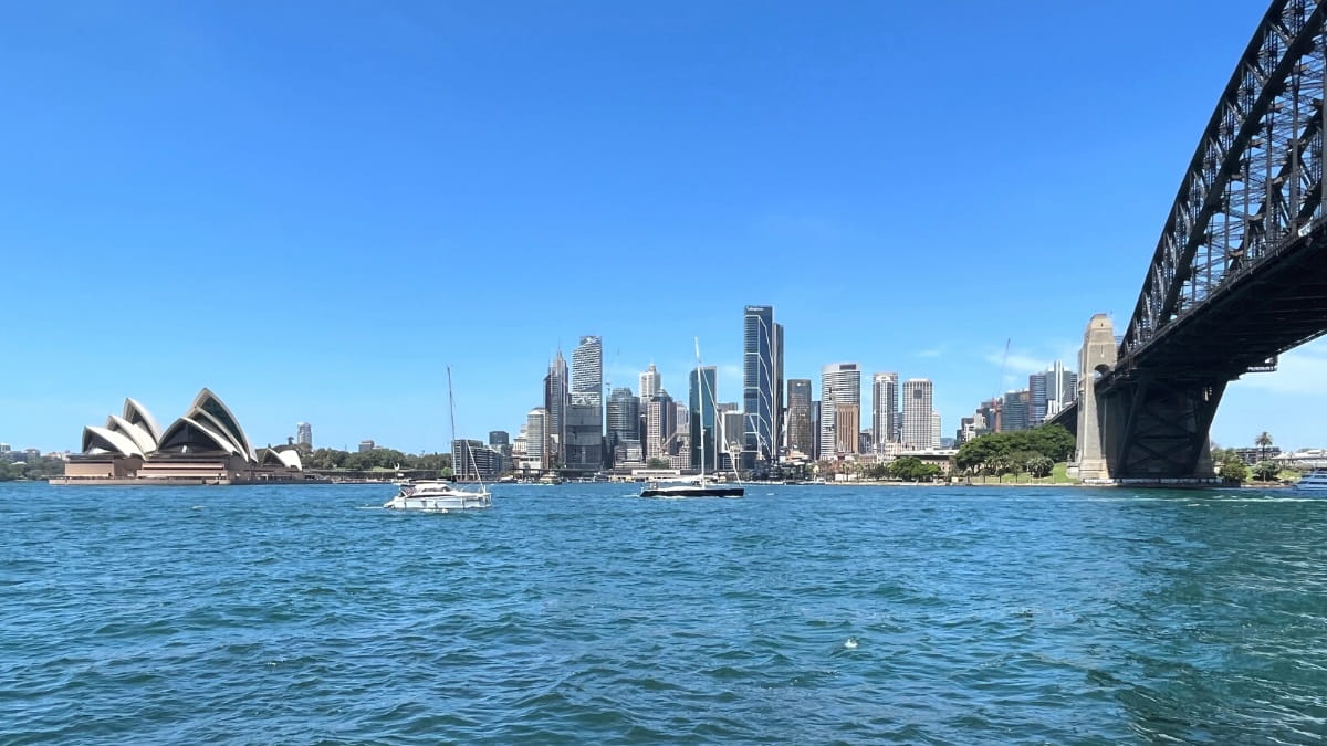
1. The Spit Bridge
The Spit Bridge is located in The Spit and carries Spit Road to connect the suburbs of Mosman and Seaforth.
The Spit Bridge was completed in 1958 and is a so-called bascule bridge. Its middle section can be raised to allow ships to pass through. The bridge has played a crucial role in the development of the northern suburbs and forms the gateway to the beaches up north.
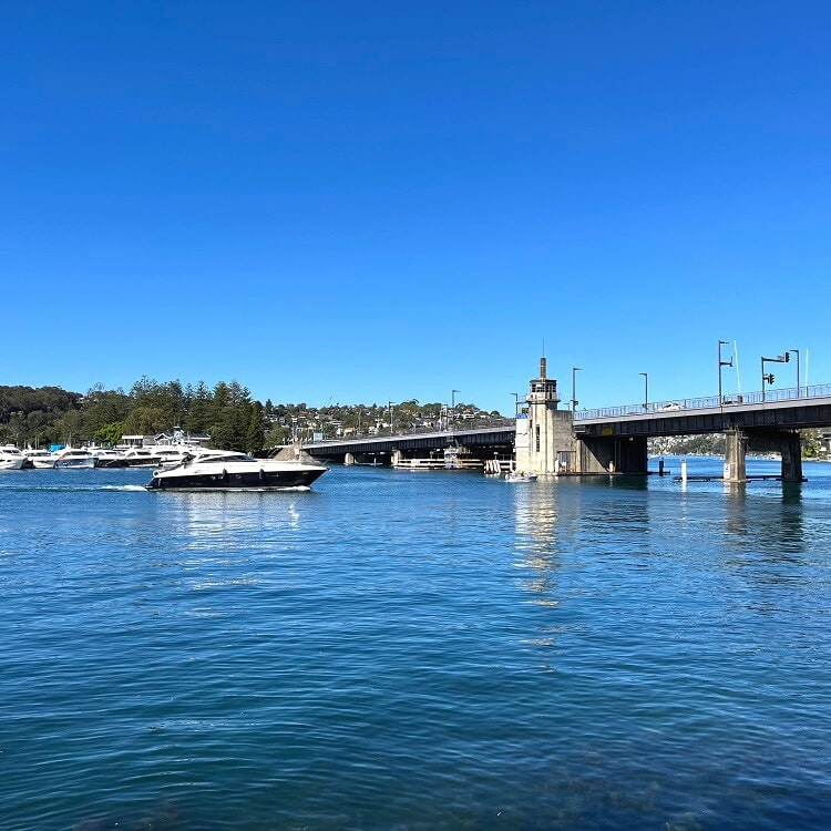
As mentioned, to start the walking track to Manly, look for the staircase at the southern end of Battle Boulevard.
Once at the water, follow the walking path under the bridge leading to Ellery’s Punt Reserve. From there, keep following this path around Shell Cove Bay, Fisher Bay, and Sandy Bay towards Clontarf Reserve.
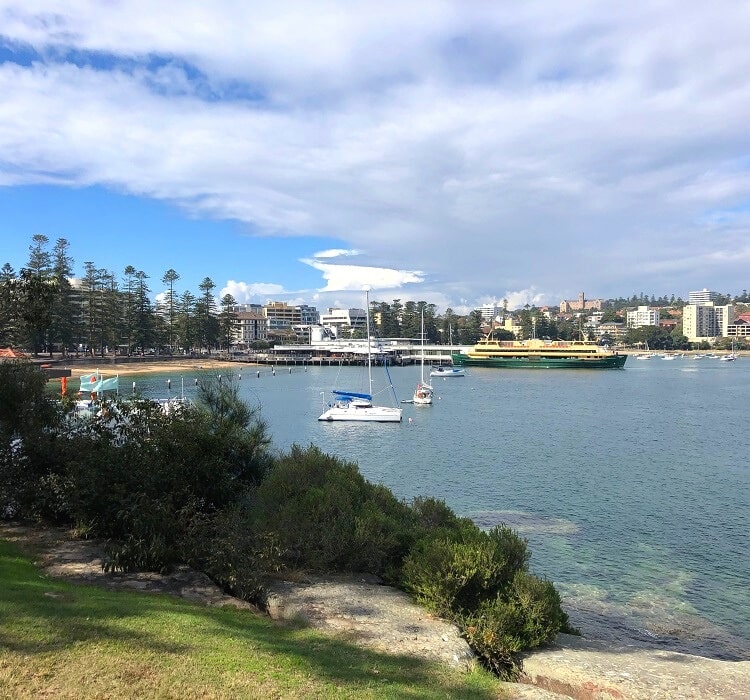
2. Clontarf Reserve
The Clontarf Reserve is a beautiful park area on Sandy Bay Road in Clontarf, with excellent picnic and BBQ facilities, a cafe and restaurant, playgrounds, toilets and showers, and various stretches of beach.
The park also has plenty of large trees that offer shade on those sunny days. The beach right in front of the park has a netted swimming area, perfect for children.
To continue the Spit Bridge to Manly Walk, follow the shoreline further north towards Clontarf Point and Castle Rock Beach. At high tide, you may need to walk along Monash Crescent to get to Clontarf Point.
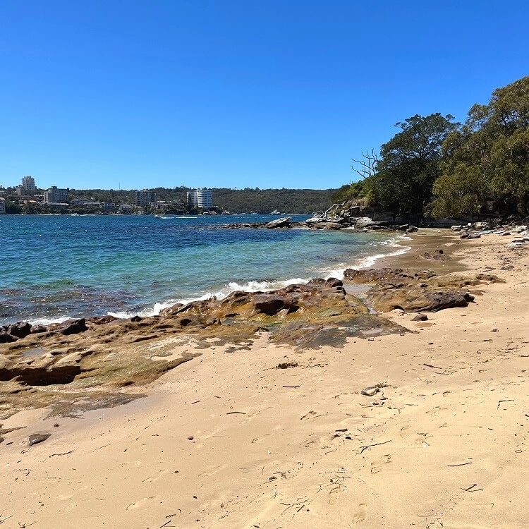
3. Castle Rock Beach
Castle Rock Beach is a small and not very well-known, secluded beach that is accessible via a short walk down a set of stairs from the Spit to Manly walking trail.
It’s the perfect beach for those looking for a quieter beach experience, away from the large sun-bathing crowds at the bigger beaches.
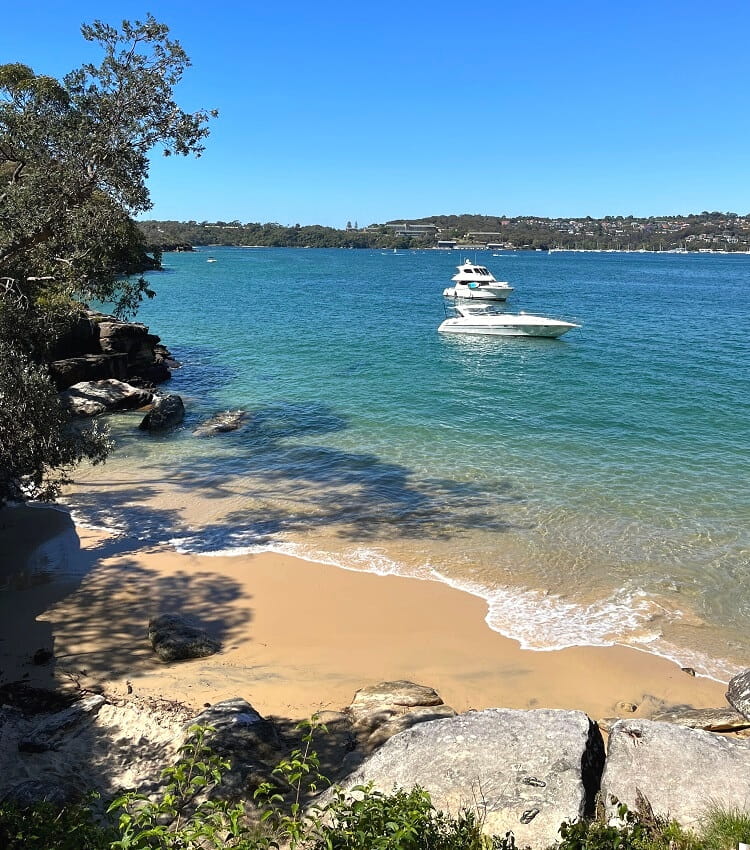
There are no facilities, so it’s best to bring food and drinks with you if you plan to hang around there for a while.
It’s a beautiful beach, but like so many small beaches in Middle Harbour, there may not be a lot of sand there at high tide.
4. Grotto Point Lighthouse
From Castle Rock Beach, the walking trail continues to the Grotto Point headland through beautiful bushland scenery.
The side trail to the Grotto Point Lighthouse and Washaway Beach is optional, but is worth it if you have the time and energy. It will be an extra 45 minutes worth of hiking.
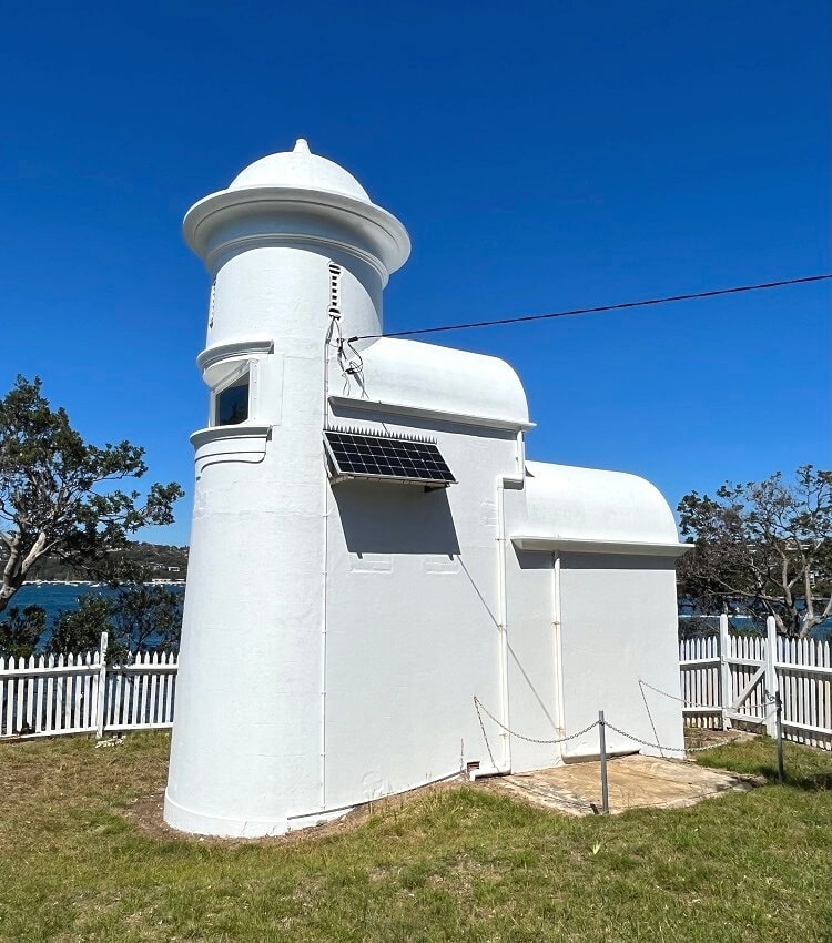
This side trail to the lighthouse is not signposted and can be easily missed. About 5-10 minutes after Castle Rock Beach, you’ll see an intersection in four directions. If you go straight ahead, you’ll continue on the main Spit Bridge to Manly walking trail. To visit the lighthouse, you need to turn right.
The 8-metre high, bright white lighthouse was commissioned in 1911 to help navigate ships entering Sydney Harbour. The lighthouse itself is closed, but the grounds are open to the public.
5. Washaway Beach
From the lighthouse, retrace your steps until you see another side trail heading to Washaway Beach.
This side trail is also not signposted but is not too far away from the 4-way intersection. The path down to this beach is quite challenging as it’s quite steep and uneven.
It will take about five minutes before you see the beach. But getting onto the beach is another challenge because the rocks surrounding the beach are quite high. Look for a makeshift ladder carved into the rocks at the northern end of the beach, where most visitors seem to head down onto the sand.
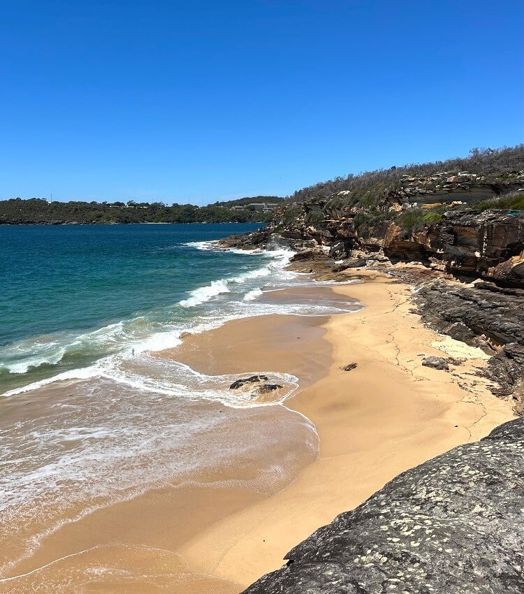
Washaway Beach is named that way because the beach can literally vanish with high tide and strong waves.
This used to be a designated nude beach, and unofficially, it still is today. In other words, you may bump into scarcely dressed sunbathers, just so you know.
Once you’ve finished exploring the lighthouse and Washaway Beach, retrace your steps to the 4-way intersection and turn right to continue on the main walking track.
6. Dobroyd Head Lookouts
Before arriving at Dobroyd Head, the track passes an area with well-preserved aboriginal rock engravings. Watch out for boomerangs, a giant kangaroo, a whale and small fish that are visible from a boardwalk.
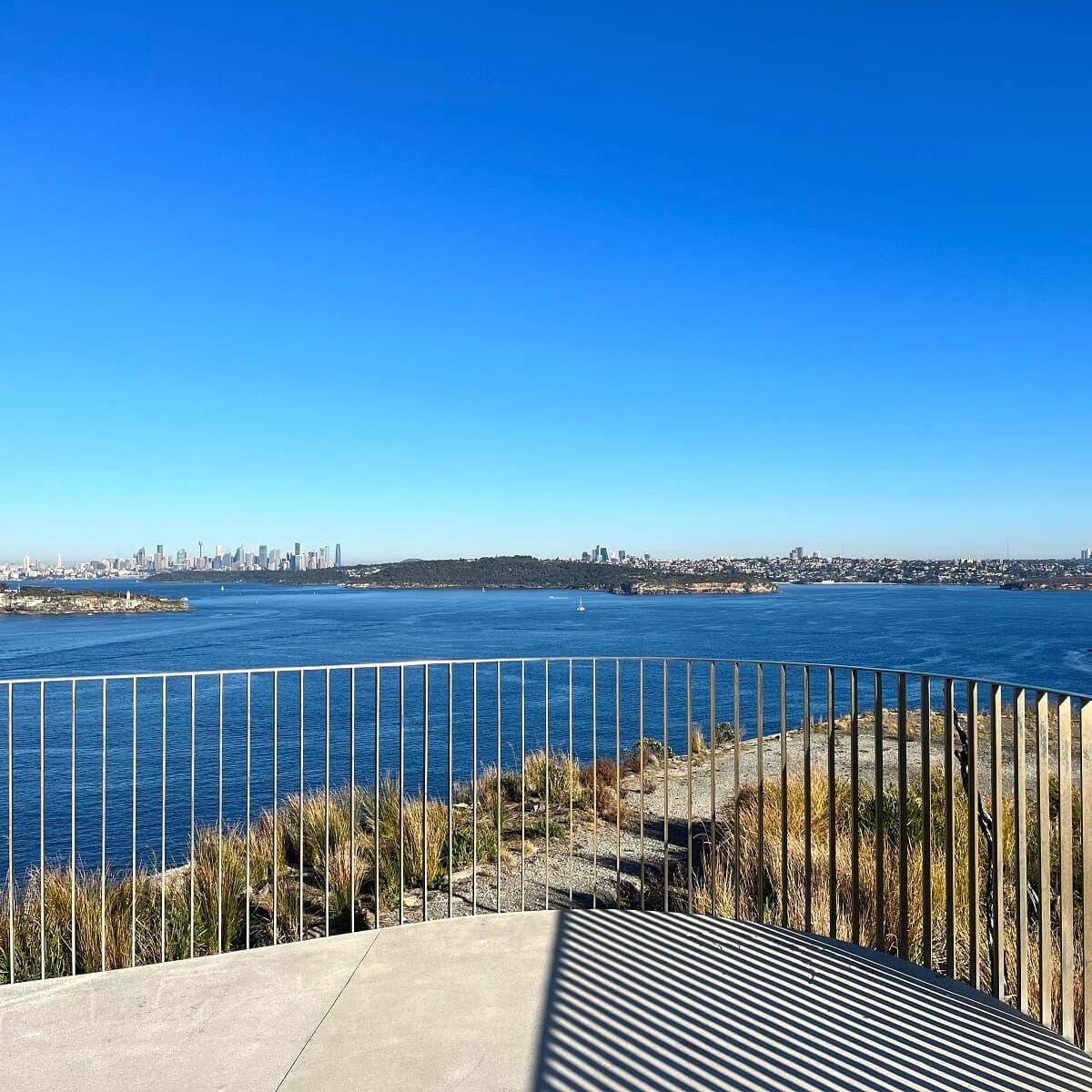
Perhaps the best part of the Spit to Manly Walk is the section at Tania Park on Dobroyd Head. Various lookout points offer fantastic views of the Habour, North Head, South Head, and the ocean further ahead.
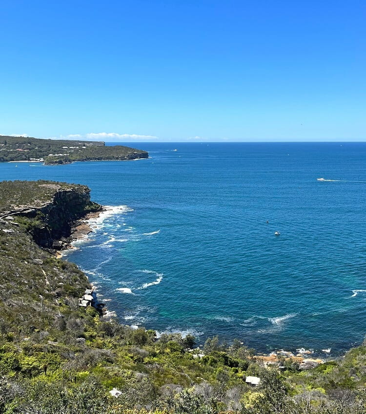
If you look down, you may be able to spot (the remains of) old shacks and huts that were constructed there during the great depression in the 20th century. There is, in fact, a steep path heading down to those shacks, if you’re keen to explore that area a bit more.
A bit further north is the Arabanoo Lookout, which is signposted. The views are a bit obstructed by the many trees, but it’s still worth visiting. This lookout was named after Arabanoo, the first Aboriginal man who lived among European settlers.
For more great vantage points like Dobroyd Head, read our guide to the most scenic lookouts in Sydney.
7. Reef Beach and Forty Baskets Beach
From Dobroyd Head, the walking track continues northbound to two more beautiful beaches.
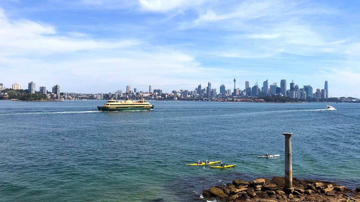
Reef Beach is a small strip of sand facing Manly Cove and the Ferry terminal on the other side of North Harbour.
This is another quiet beach that was once a nudist strip of sand. The views are great, especially from the boardwalk right behind the beach.
The next beach, Forty Baskets Beach, is a family-friendly strip of sand with often calm waters perfect for swimming.
The beach is protected from the waves and also has a swimming enclosure. Behind the beach, you’ll find picnic areas, a small playground, toilets and showers.
8. North Harbour Reserve
From Forty Baskets, the walking track continues northbound past the North Harbour Sailing Club to North Harbour Reserve.
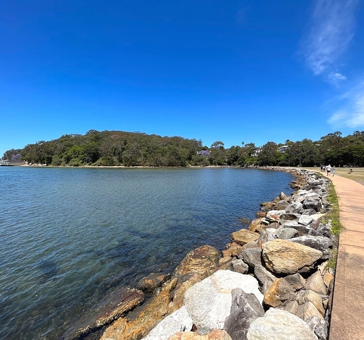
This beautiful waterfront reserve is a large open parkland with electric BBQs, a playground, a basketball court, and picnic tables.
With a fantastic photogenic backdrop, North Harbour Reserve is also a popular spot for wedding ceremonies and other formal events.
9. Fairlight Walk
The last stretch of the Spit to Manly Walk is the Fairlight Walk, which follows the shoreline between North Harbour Reserve and the Manly ferry wharf.
Popular with tourists and locals, the pram-friendly Fairlight Walk is mostly a paved track with beautiful views of North Harbour and Manly Cove.
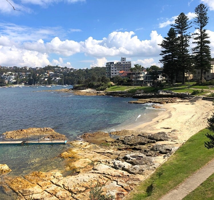
One of the highlights along this path is Fairlight Beach, an 80 metres long stretch of sand with a small rock pool.
It’s one of the many secluded beaches you will discover along the coastal trail between the Spit Bridge and Manly Beach.
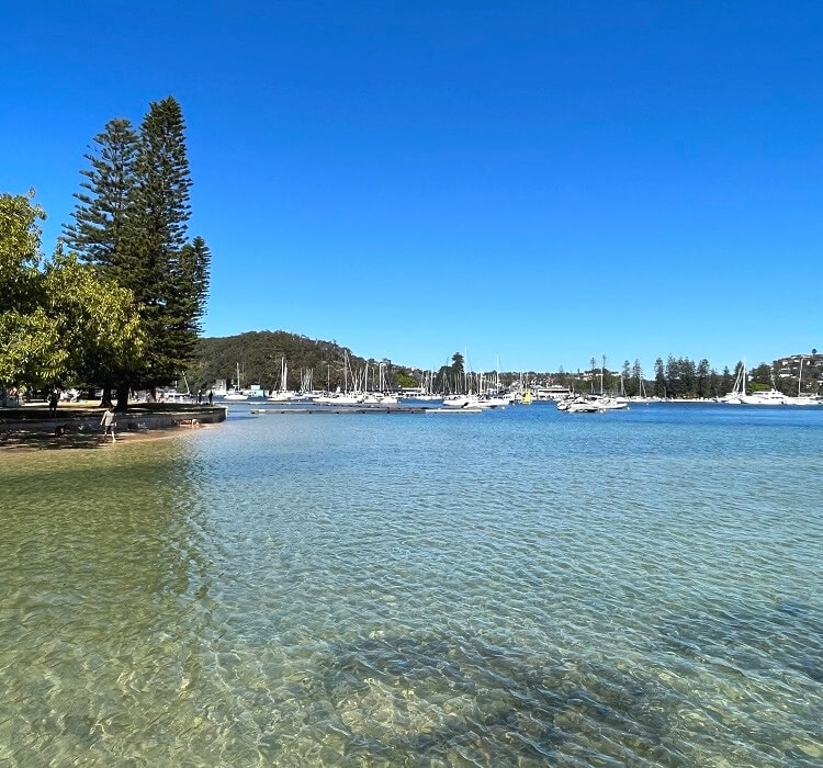
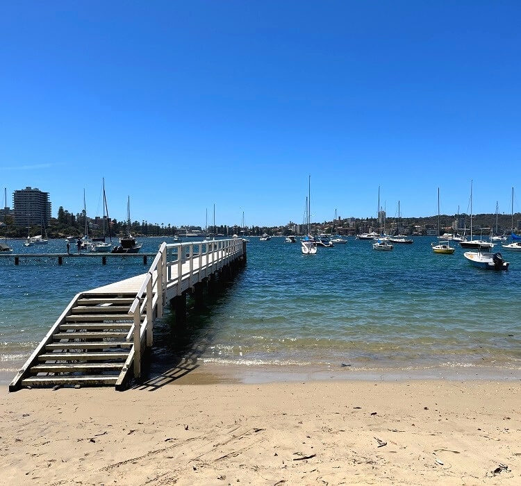
10. Manly Wharf
With Manly now in sight, keep following the walking path past the Manly Pavillion and Cabbage Tree Beach until you arrive at Manly Wharf, which marks the end of the Spit Bridge to Manly Walk.
Now it’s time to go and explore Manly, with so many things to see and do. There are beaches on both sides of the Manly Corso, with the beaches on the ferry wharf side much quieter and more family-friendly.
The Corso is a long strip of shops, cafes, and pubs, so there are lots of options to go for lunch, a coffee, and perhaps a cold beer.
If you need some inspiration, check out our guide to the best things to do in Manly with a list of top attractions and activities.
More Hiking
The Spit Bridge to Manly Walk is part of the longer Manly Scenic Walkway, which is almost 20 km long. This epic hiking trail also includes a 9.5 km circuit track on Manly’s North Head.
It will take around 3 to 5 hours to complete, so if you’re keen to do the entire walk, you’ll be hiking anywhere between 6 and 10 hours.
If you’re up for an even bigger challenge, read our guide to the Bondi to Manly walking track, an 80 km long coastal adventure between Sydney’s two most famous beaches.
Guide to the top things to do in Sydney.
Just so you know Washaway Beach is definitely still a nudist beach. Now that the sand is back the nudists have also returned.
This is a great walk, albeit a popular and busy one! The history of the old shacks around Crater Cove is very interesting, and worthy of a future trip!
Thanks for the great tip, Oliver!
Thanks for the great post. Just completed this walk today! Didn’t realize that the Spit Bridge to Manly Hike didn’t have to include North Head. I’m so glad to have done the full 20k in 5hr 30min but still would have liked to have found your blog post first! I’m taking a little rest from hiking the next few days 🙂
Wow Sophie, that’s very impressive, especially with the warm weather we had yesterday! Glad to hear you enjoyed the hike 🙂
Is their any steps on the walk as I’m in a chair.
Kind regards, Anthony.
Hey Anthony, unfortunately yes, there are steps and other obstacles on this walk.