Last updated: February 26, 2024
The Victoria Falls walking track in the Blue Mountains takes in a beautiful lookout, a fantastic waterfall, and a unique cascade water spectacle.
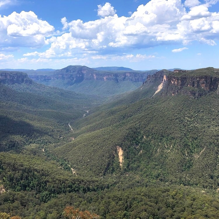
Perched on a cliff edge overlooking the Grose Valley, the Victoria Falls lookout is the starting point of a short but very steep bushwalk to two of the prettiest waterfalls in the Blue Mountains.
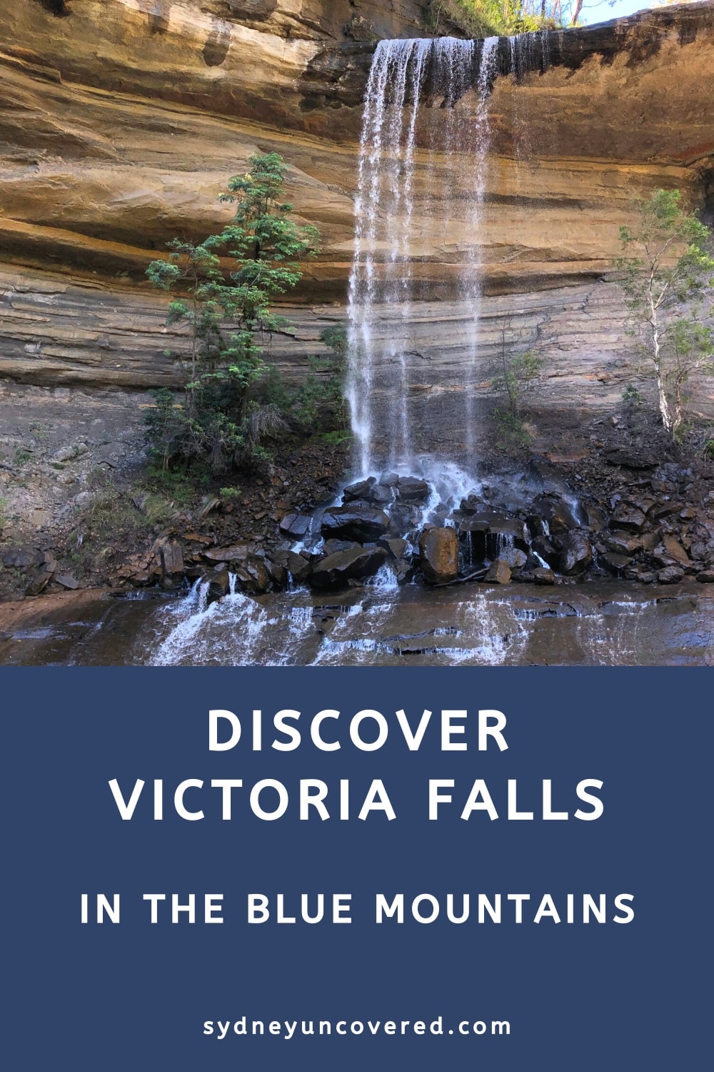
Victoria Falls is a stunning waterfall on Victoria Creek that drops 20m from a rock overhang, and the nearby Victoria Creek Cascades further upstream is a smaller waterfall in beautiful surroundings.
| Victoria Falls Track | |
|---|---|
| Distance: | 4 km (return) |
| Elevation: | 400 m |
| Time: | 2 hours (depending on stops) |
| Grade: | Moderate / hard (very steep) |
| Dogs: | Not allowed |
How to Get There
From the Great Western Highway in the Blue Mountains, turn into Victoria Falls Road, north of Blackheath and just south of Mount Victoria.
Be mindful that this road isn’t properly signposted, and it’s quite easy to miss the turn-off altogether and drive past it.
Also note that Victoria Falls Rd is unsealed, but it is in good condition. A 4WD vehicle certainly isn’t required, but it is recommended to always drive carefully, especially after some rainfall.
After about 5 km on this road, you will arrive at a small car park and a picnic area. The start of the track is at the eastern end of the car park (see map).
Map
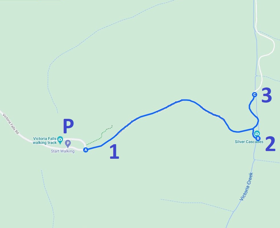
Here is a map of the Victoria Falls Track with the three highlights marked:
- Victoria Falls Lookout
- Victoria Creek Cascades
- Victoria Falls
Victoria Falls Track Notes
One beautiful lookout and two scenic waterfalls; that’s what you get to discover when doing the steep Victoria Falls Walking Track down into the Grose Valley.
Be mindful that this hike is indeed very steep. It’s easy enough on the way down, but quite challenging on the way back up. Make sure you come prepared with appropriate footwear and a bottle of water. That water will be much needed, especially on a warm day.
And if you’re keen to swim, both the waterfall and the cascades feature beautiful waterholes that are very suitable for a quick splash.
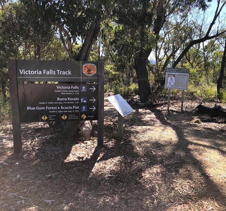
Once you’ve parked your car, look for the Victoria Falls Track signage. From there, head into the bush and start hiking!
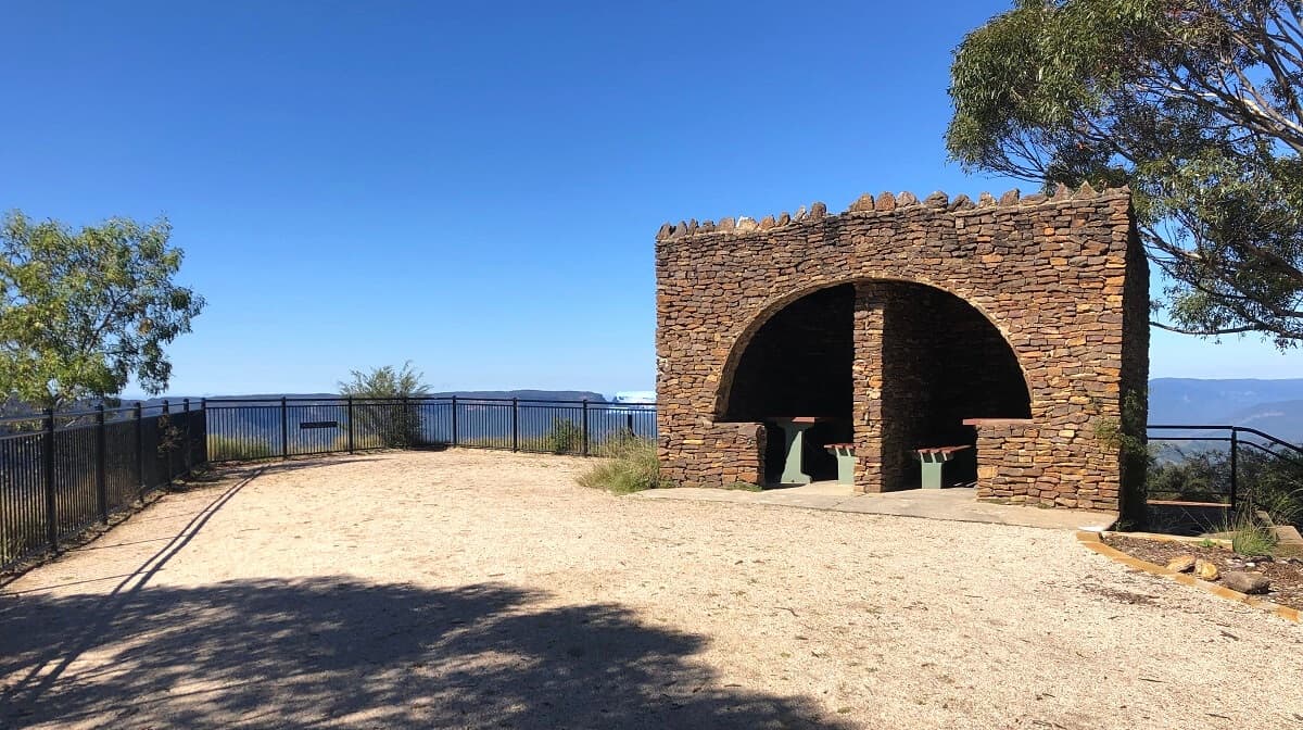
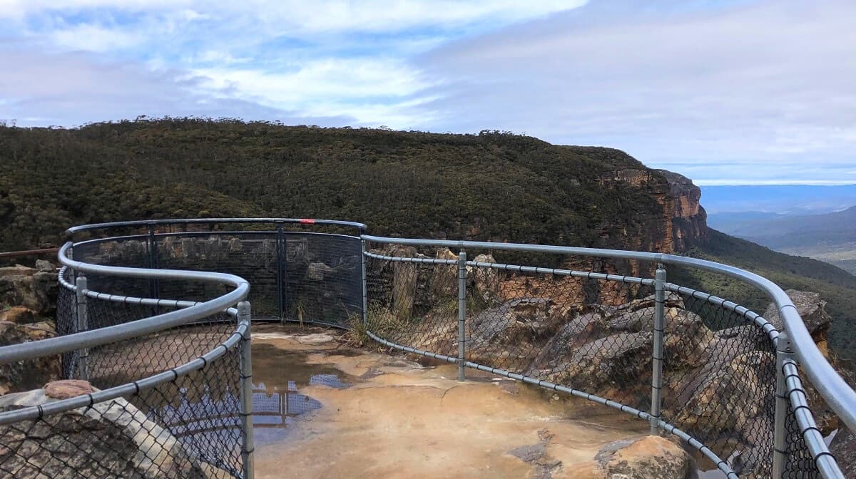
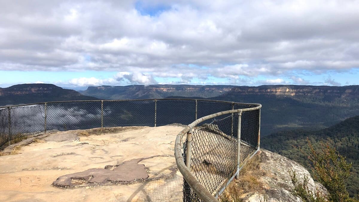
1. Victoria Falls Lookout
After only a few hundred metres, the walking track arrives at the beautiful Victoria Falls Lookout, otherwise known as the Grose Valley Lookout.
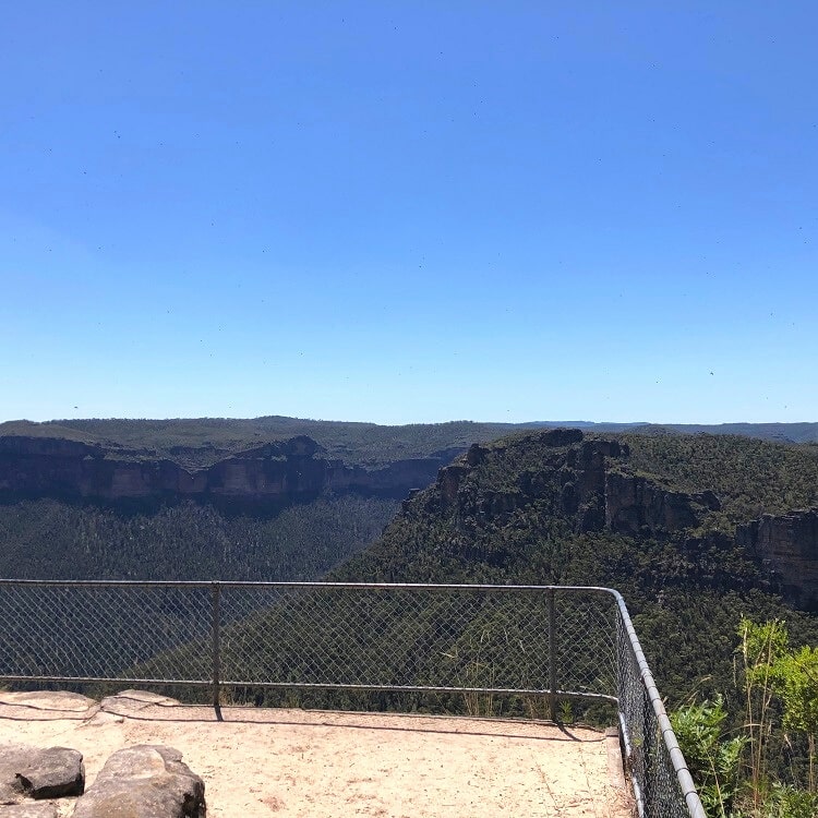
This lookout is considered one of the most scenic lookouts in the Blue Mountains region, with fantastic valley views to take in.
The waterfall and cascades aren’t visible from the lookout, though. To see those two beautiful sights, you will need to undertake the steep descent into the valley.
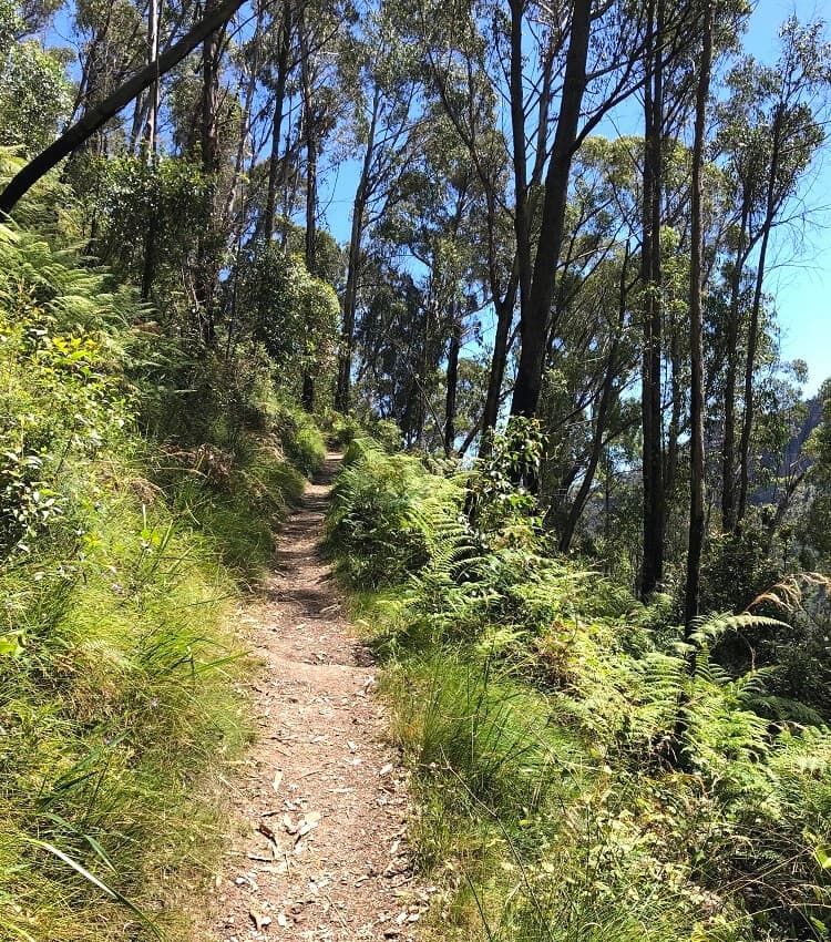
From the Victoria Falls Lookout, continue on the main track to begin that steep but exciting descent to Victoria Creek.
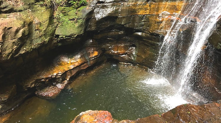
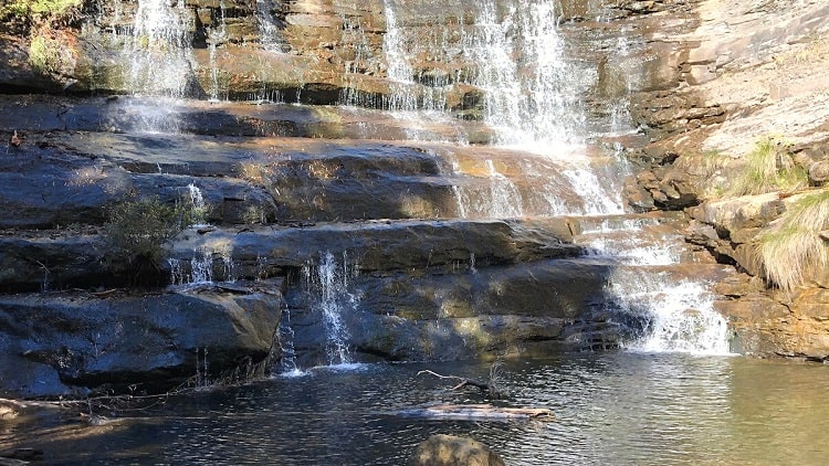
2. Victoria Creek Cascades
It’s an easy-to-follow, zig-zag style walking path, first through an area of rocky outcrops and slowly evolving into a greener, rainforest-like environment.
As the sounds of the waterfall and cascades get louder, the track eventually arrives at a junction where things may get a bit confusing.
The sign at the junction says Burra Korain Flat to the left, and Cascades to the right. It doesn’t actually mention Victoria Falls, but the path to the left will get you there.
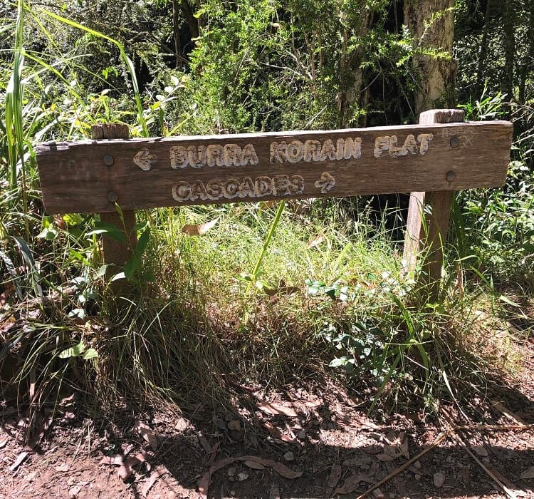
Because the sign doesn’t mention the waterfall, you might even think that the cascades are the actual waterfall, and potentially miss out on visiting Victoria Falls altogether.
For the best experience, visiting the cascades first is recommended, which is only a short walk away from that sign, turning right.
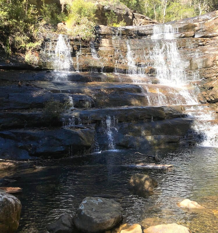
With a bit of rock scrambling, it’s possible to get very close to the cascades. On a warm day, feel free to dip your feet into the pool’s water at the base of the cascades.
It’s a very pretty sight, especially with the rocks, cliff walls and large trees surrounding the cascades.
The path to Burra Korain Flat extends along the Grose River and ultimately leads to the Blue Gum Forest, which in turn connects with Perrys Lookdown and Lockleys Pylon.
3. Victoria Falls
To visit the beautiful Victoria Falls waterfall, retrace your steps to that junction and follow the path heading towards Burra Korain Flat.
What’s great is that you can visit both the top and bottom of this amazing waterfall. The top of the waterfall can be reached via a short side track (signposted), and offers nice views of the creek flowing through the forest.
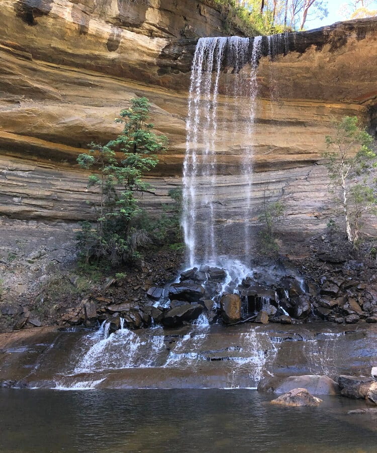
To get to the bottom of the falls, continue on the main path along the creek and keep walking until you see the waterfall appearing.
On a warm day, by all means, go for a swim in the waterhole at the waterfall’s base. This natural swimming pool is bigger than the one at the Cascades, and there are fewer rocks to negotiate.
It’s a very pretty and peaceful area, and swimming in that pool is a wonderful experience. On a warm day, it’s best to go early because it can get a little busy there, especially on the weekends.
If you’re keen to find other spots to swim, check out our list of scenic waterholes in the Blue Mountains for some great options.
Ikara Head walking trail.